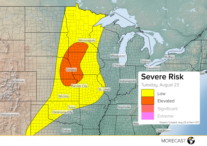
After a fairly quiet past few days, severe storms are to ramp back up this afternoon into night across the Plains and Midwest.
Currently there is a cold front that runs through central North Dakota into Wyoming which will gradually move across the High Plains today. Forcing from the front will be what triggers these storms with help from ample moisture and instability. While strong damaging winds and large hail will be the main threat to focus on; isolated tornadoes are not out of the question for the ‘elevated’ risk region. The stronger more severe storms are to develop around 2 pm CDT. Storms will have northeast movement that continues through the evening.
We’ll continue to issue updates over our social media feeds (Twitter and Facebook) as long as the storms pose a potential threat. Also, don’t forget to upload any pictures to the MORECAST app of storm damage as long as it is safe to do so.