As winter draws to a close much of QLD and NE NSW will get an early taste of Spring storms and rain.
A surface trough will deepen on Tuesday across central QLD into NE NSW. Concurrently, an upper level trough will move over NSW and QLD amplifying the surface feature, resulting in thunderstorms and heavy rain for much of central QLD.
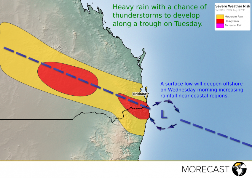
The upper level system will move further east tomorrow night and on Wednesday, pushing the main rain-band into Brisbane area and NE NSW.
A surface low will form offshore on Wednesday morning, increasing rainfall along the coastal regions before moving away to the east during Wednesday afternoon.
Rainfall totals for this event range between 25-50mm, however, localised totals of 80mm in the far SE of QLD and NE of NSW is not out of the question!