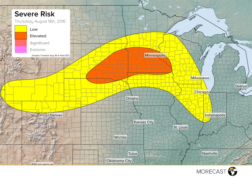
A low pressure system tracking over the Dakotas will bring a chance for severe storms across portions of northern Plains and upper Midwest Thursday.
A warm front will be lifting north out of Iowa into central Minnesota and western Wisconsin with a cold front moving southeast through South Dakota. Scattered storms will begin to develop along the cold front in South Dakota and east central Minnesota during the afternoon and will carry a wind and hail threat with any of the stronger cells. Storms will push east into southern Minnesota during the late afternoon and evening with a continued wind and hail threat but isolated tornadoes will also be possible. Storms will reach the Twin Cities area after 7 pm and will carry mostly a wind risk mainly to the south of the city.
Scattered storms will also develop ahead of the warm front and will bring mainly an isolated wind risk to Wisconsin and Illinois. There will be an isolated wind and hail risk across southern Wyoming and far northern Colorado.
You can follow MORECAST on Twitter and Facebook for updates.
