Summer 2016 has brought on the heat with record high temperature being broken across the country. A strong cold front will usher in some cool relief for parts of the Plains and Northern Rocky Mountains later today through the weekend, with temperatures greater than 20 degrees below average for this time of year possible!
A cold front is slowly moving to the south through the Northern Plains and Northern Rocky Mountains, associated with showers and storms. A strong ridge of high pressure will move into the region on Friday and linger through early next week. With a cool and stable airmass, cloudy and cool weather will persist over the region through the weekend.
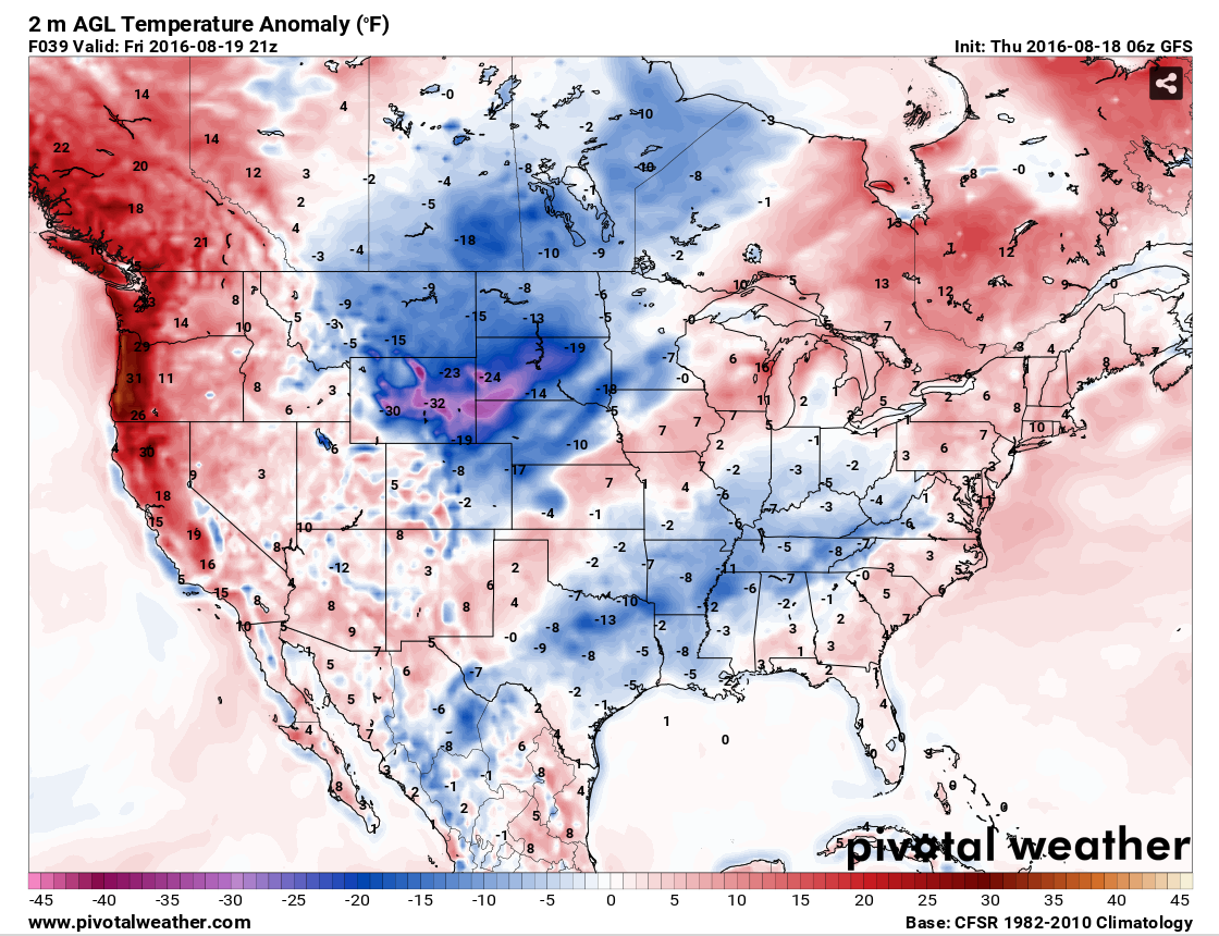
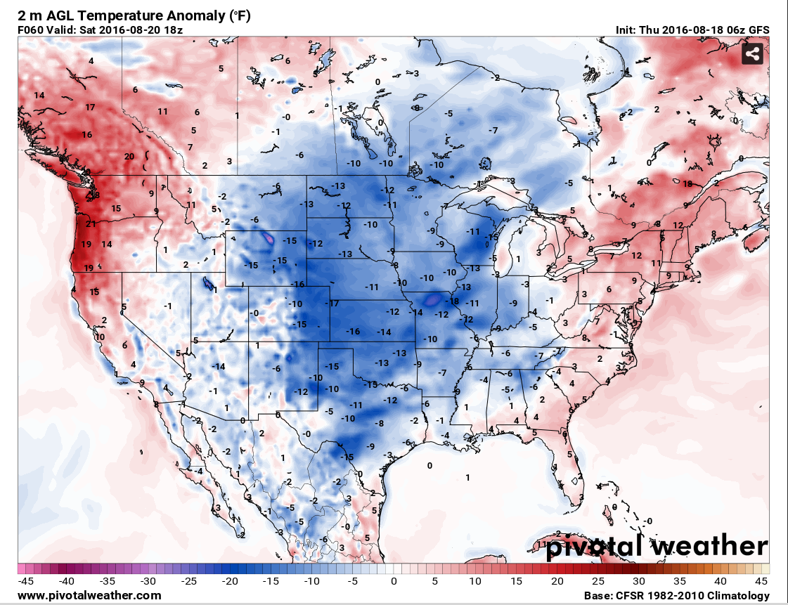
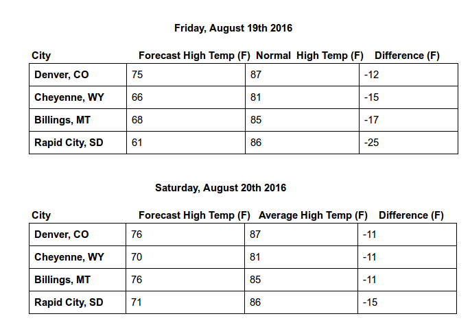
The GFS 2 meter temperature anomaly shows below average values approaching greater than 20 degrees for the Plains and Northern Rockies on Friday and Saturday. The chart below iillustrates the departure from average for some major cities across the region.
The cool and crisp air will definitely foreshadow fall coming up. The forecast calls for a rebound in temperatures early in the upcoming work week. Make sure to stay up to date with MORECAST on the app and follow us on our Facebook/Twitter pages.