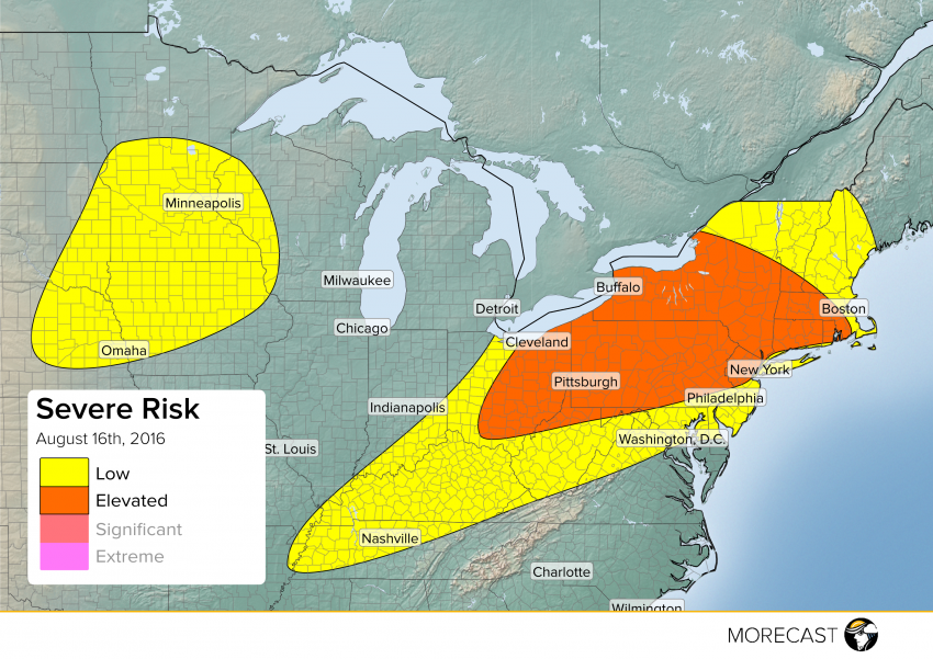
A low pressure system tracking through southeast Ontario will bring an active day to the eastern Great Lakes and Northeast with scattered severe storms.
A warm front will lift north through central New York, Connecticut, Rhode Island and Massachusetts and this will kick off scattered storms during the late morning into the early afternoon. Ahead of the warm front, storms will carry mainly a wind and hail risk, but behind the front across mainly central New York into Connecticut and Massachusetts you could see a few isolated tornadoes.
A cold front will bring scattered storms from Tennessee northeast through Kentucky and Ohio during the afternoon. The front will continue to push east kicking off scattered activity for Pennsylvania, New York and New Jersey during the mid afternoon. Wind and hail will be the main threat with any of the stronger storms, and stronger storms are expected to be a bit more widespread across eastern Ohio, Pennsylvania, New York and northern New Jersey.
Further west there will be chance for some scattered severe storms over portions of northeast Nebraska, southeast South Dakota, Iowa, southern Minnesota into far western Wisconsin. Scattered storms will develop during the later afternoon into the evening and will carry a wind and hail threat with any of the stronger cells.
Be sure to follow MORECAST on Twitter and Facebook for updates throughout the day.