There could be some relief in the forecast later today into tomorrow! A cold front will start moving across the Northeast that will help dry out the atmosphere a little. The warm temperates will still be there but dew points will start to drop as this cold front moves through today into tomorrow.
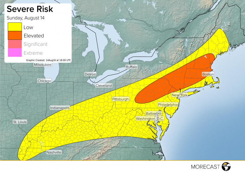
Yesterday ended up being a very active day across much of the Northeast with over 140 wind reports. Today the environment is pretty similar. We have the very warm temperatures, moist air, instability and a forcing mechanism that will help trigger these storms this afternoon. Today the main threat will once again be wind with storms starting this afternoon and ending early evening (around 8 or 9 pm EST).
Download the MORECAST app and upload pictures of storms or storm damage when it is safe to do so!
Follow @MORECAST_USA