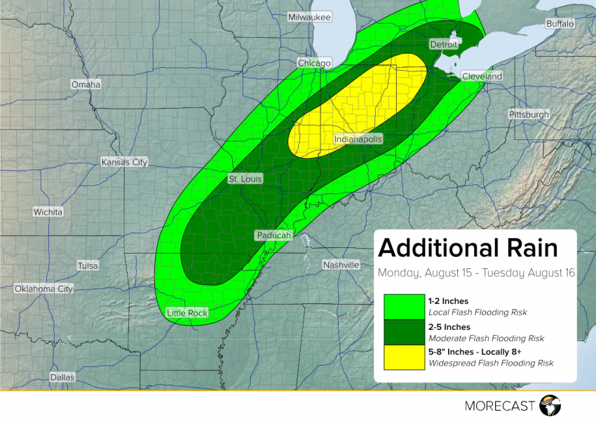
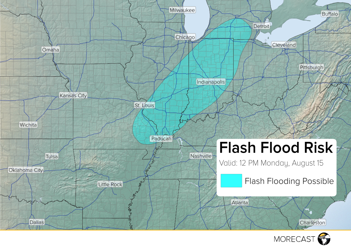
A front across the Midwest with waves of tropical moisture riding north along it have brought torrential rainfall to Missouri and southern Illinois, resulting in periods of torrential rainfall from today into Tuesday. Conditions will continue into Tuesday, with the threat of flash flooding shifting towards central Illinois and Indiana.
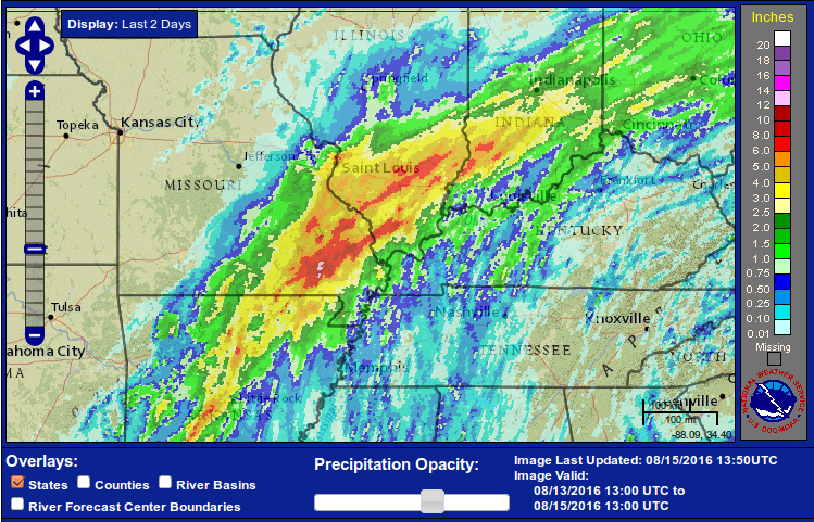
On Sunday, heavy rain fell along a stationary front with several total rainfall amounts over 4 inches. Local roads in portions of Missouri and southern Illinois were impassable on Sunday. Several roads were closed in St. Louis and power outages were reported throughout the city. Additional rain of 2-5″ is expected to fall today in St. Louis, likely leading to additional outages and closures.
As above normal moisture continues to be pulled into the Midwest, heavy rainfall and flash flooding will be possible today into Tuesday from Missouri to Ohio. Portions of eastern Illinois and central Indiana are at the greatest risk for flash flooding, with 5-8″ of rain possible. By Tuesday evening, the rain will begin to move further east and rainfall rates will begin to slow. With excessive rain expected throughout the area today into Tuesday, residents are encouraged to stay alert as flooded roads and rivers can quickly lead to life threatening conditions.
Check out the MORECAST app for a pinpoint rainfall forecast in your area and be sure to share your weather photos on the MORECAST community page when conditions are safe.