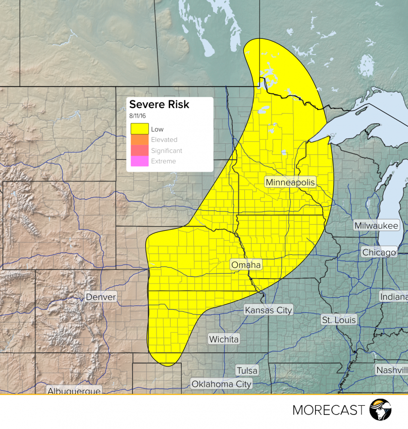
Watch for some severe weather to pop up across portions of the Upper Midwest and Plains today.
Some severe weather will impact portions of the Upper Midwest and Plains this afternoon and evening. Locally severe activity could extend northward into far southeastern Manitoba and southwestern Northern Ontario as well.
An upper-level system will move eastward through southern Canada, with associated surface fronts and boundaries extending southward through the Plains and Upper Midwest. A few areas of surface low pressure will develop, aiding in lift and storm development. Plenty of heat and moisture energy will fuel storms, with the strongest storms producing wind gusts to 70 mph and hail to 2.5 cm in diameter. An isolated tornado cannot be ruled out. Heavy rain will accompany these storms with the heaviest storms producing up to 3 inches of rain in a short period of time. Watch out for local flash flooding in these heavy storms. Minneapolis, MN and Omaha, NE will be the major cities seeing storm impacts today!
Download the MORECAST app to keep an eye on the skies in your backyard!
