Heavy storms will move slowly along a stalled boundary tonight, producing hours of torrential rainfall and leading to widespread flash flooding, especially across northern Iowa.
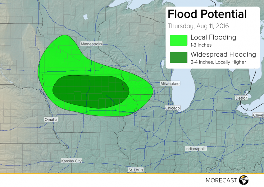
Widely scattered storms will become more numerous late this afternoon into tonight over parts of southern Minnesota, Iowa, far northwestern Illinois, and southwestern Wisconsin as unusually moist air flow interacts with a stationary boundary. There is a limited severe threat, but the storms will also be slow-moving and tend to train, leading to prolonged, prodigious rainfall rates of 1-2″/hr. The heaviest rain will fall across northern Iowa, where amounts of 2-4 inches will be common with a few isolated 6-7 inch totals. Widespread flooding is expected in this area. Flooding may be more localized elsewhere but still dangerous.
Travelers using I-35 between Des Moines and Minneapolis should pay special attention to weather alerts later tonight. We’ll keep you informed over our social media feeds (Twitter and Facebook) as well as the MORECAST app!