High pressure near the Carolina coast pushing hot and sticky weather into the Northern Tier as southwesterly flow around the high pumps ample moisture and warm air in from the Gulf. High dew points in the mid 70’s are combining with air temperatures in the upper 80’s to mid 90’s to cause heat indicies to top out at over 100°F in some cities.
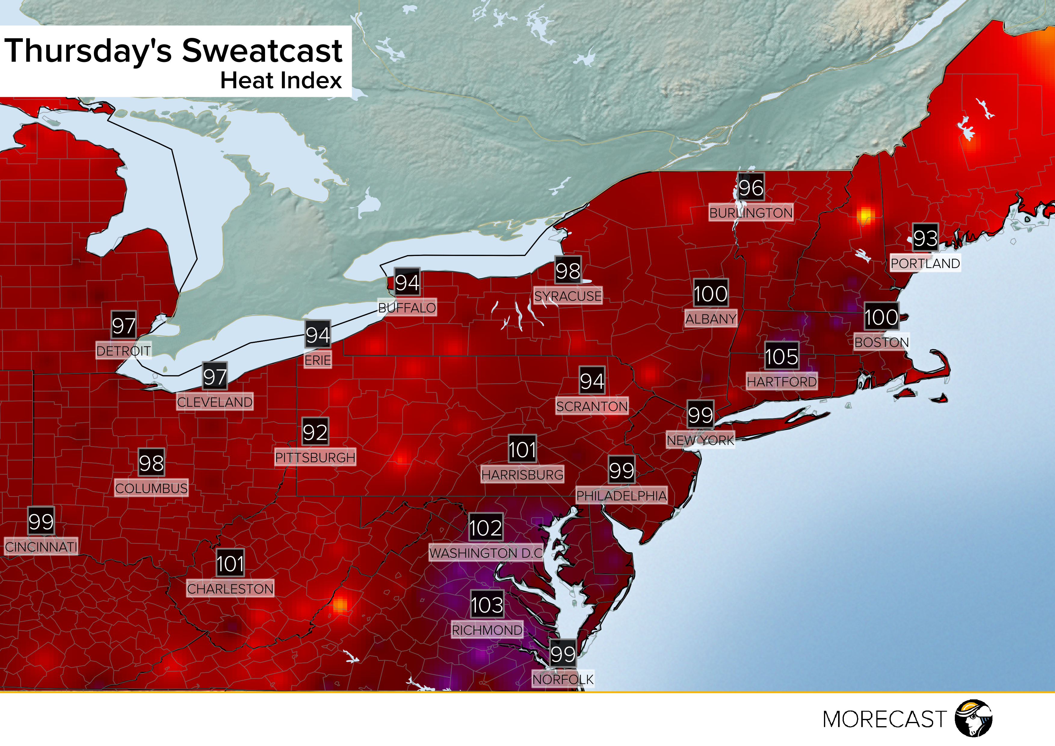
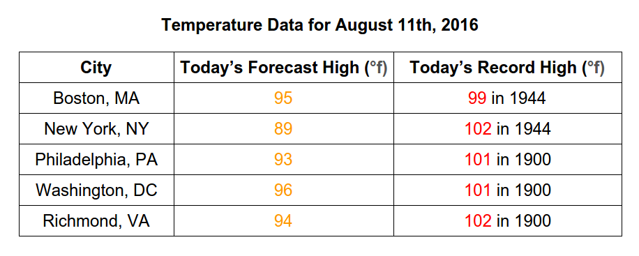
Thursday’s actual high temperatures, while hot, are not record challening for most locations. The table below shows that the record highs across some major Northeast and mid-Atlantic cities for Thursday are around or a couple of degrees over 100°F.
Looking to Friday conditions won’t ease much as oppressive dewpoints in the mid 70s will hold firmly in place along the I-95 corridor. Again this humidity will meet temperatures close to the 90° mark allowing for heat index readings above 100°F. As the MORECAST Sweatcast below shows, Thursday’s weather will be replicated to end the work week.
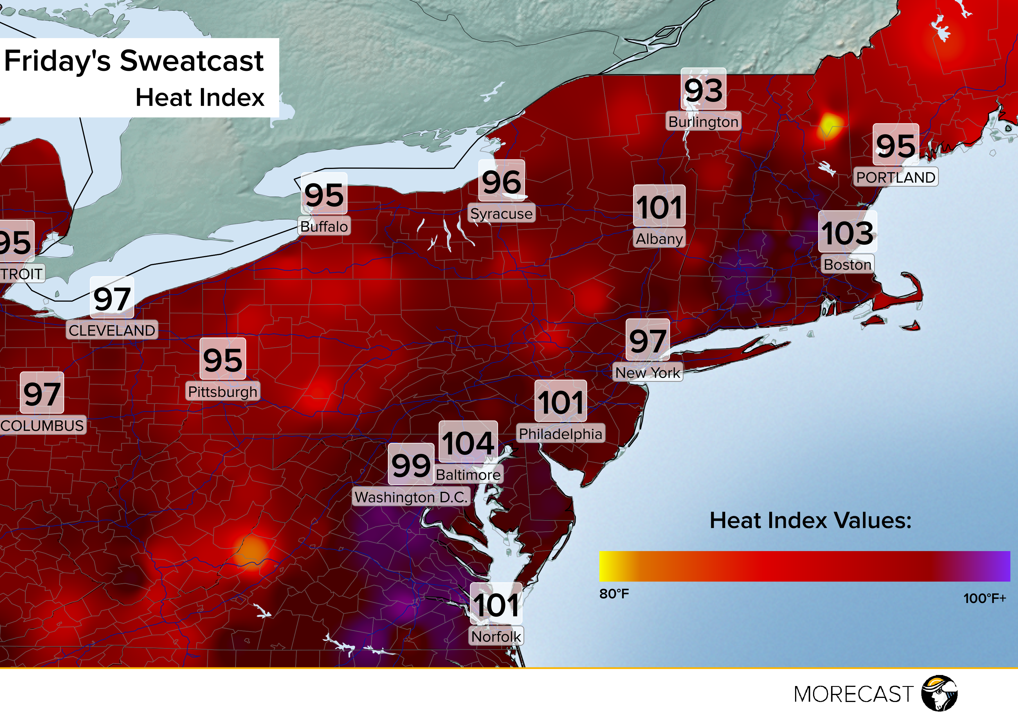
This pattern is extremely persistent and will likely hold form through the weekend prompting numerous excessive heat watches and other heat advisories through Sunday.
It is definitely feeling like the Dog Days of Summer in the Northeast. Try to limit your time outside during the next few days, and be sure to drink plenty of water as you try to beat the heat.