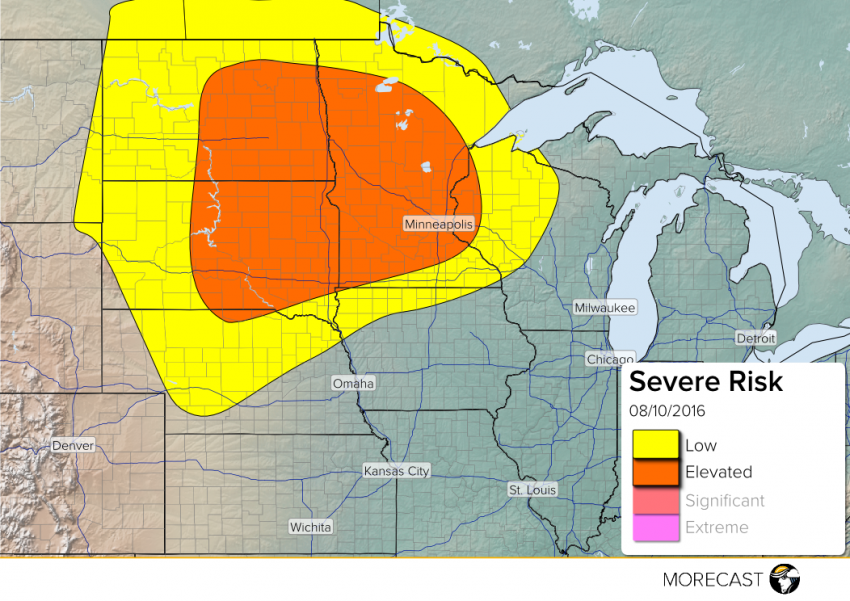
Severe thunderstorms are expected to develop this afternoon/evening across South-North Dakota and move eastward into Minnesota/Western Wisconsin during the evening and early overnight.
A warm front will continue to move northward across Minnesota, Eastern South Dakota, and Eastern North Dakota through the evening. An area of low pressure is over Northern South Dakota will move northeastward. With some good upper level support and clearing, this will allow for scattered severe storms to set up to ahead of the cold front and behind the warm front.
The main hazards will include hail up to 2″, wind gusts up to 70 mph, isolated tornadoes, and localized flash flooding. Some major cities at risk include Minneapolis-St. Paul and Fargo, North Dakota.
Download the MORECAST app for the latest weather forecast for your location.