As of Tuesday afternoon, what was Tropical Storm Javier had weakened to a tropical depression over the Baja Peninsula in Mexico, with peak sustained winds of just 35 mph, with further weakening expected Tuesday evening.
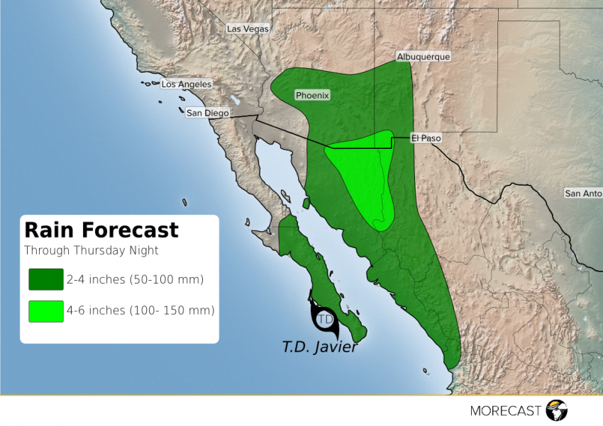
While the overall storm is falling apart, there remains an abundant amount of moisture in the atmosphere extending from the Gulf of California up into the Desert Southwest, with flash flooding already occurring across parts of southeast Arizona. This ‘highway of moisture’ will continue through Thursday, meaning the threat for flash flooding goes on across much of southern Arizona into western New Mexico until the end of the week.
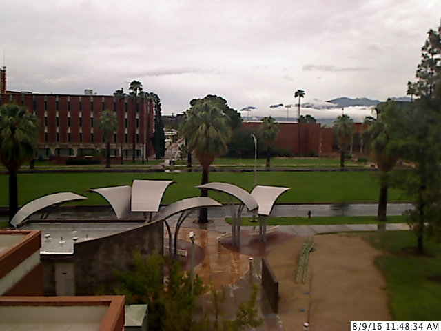
Flash Warnings were already issued in and around Tucson Tuesday morning, where up to 2″ of rain has already fallen, with up to 3″ of rain closer to the Arizona-New Mexico-Mexican borders. The rain was heavy enough that the University of Arizona told students not to come to campus due to the road conditions. Another couple inches of rain will be possible in the next couple of days before drier air moves in on Friday.
Rain has also started to move into the Phoenix area, with a couple of inches possible in parts of the Valley of Sun, with locally higher amounts in stronger storms. A flash flood watch is in effect across the metro area. Gusty storms also led to a dust storm for the Phoenix area Tuesday morning drastically reducing visibilities down to a quarter mile.
As for the rain, the highest rainfall totals are likely to be in the higher elevations of Arizona and New Mexico, where up to 6″ may fall. As is usually the case in the Southwest, flash flooding can wreak havoc even in areas where rain is not actually falling, as the fast moving waters can spread out through streams and washes, so anyone in southern Arizona and southwest New Mexico should be on extra alert from now until Friday morning.