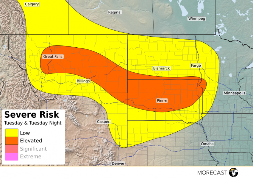
Severe thunderstorms are expected to develop Tuesday afternoon and continue into Tuesday night from Montana eastward into South Dakota and southern North Dakota.
A cold front will extend from north-central Minnesota southwestward to an area of low pressure across northeastern Wyoming by dusk on Tuesday. Ample moisture and instability will be drawn northward toward the frontal boundary setting the stage for strong to severe thunderstorms to erput generally after 2pm MDT. Damaging wind in excess of 60 mph and large hail over 1 inch in diamter are the main concerns.
Great Falls to Billings, Montana eastward to Pierre, South Dakota are a few of the cities at risk for the severe weather.
Initially, storm development will be descrete, and an isolated tornado cannot be ruled out within one of the descrete cells. During the evening hours, storms will tend to cluster into a more defined complex as they travel east across the Dakotas. Storms could reach western Minnesota by early Wednesday morning in a weakened state.