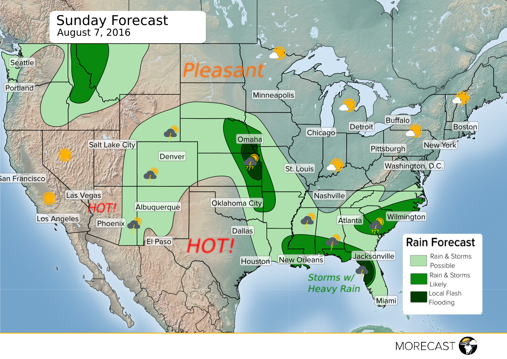
The first weekend of August will start off with a cold front moving through the Northeast, bringing scattered showers and thunderstorms Saturday afternoon and evening. Storms that do form in the Northeast will be capable of gusty winds around 40 mph, with a few isolated storms possibly becoming severe with 60 mph gusts. The second half of the weekend will bring pleasant weather to the area.
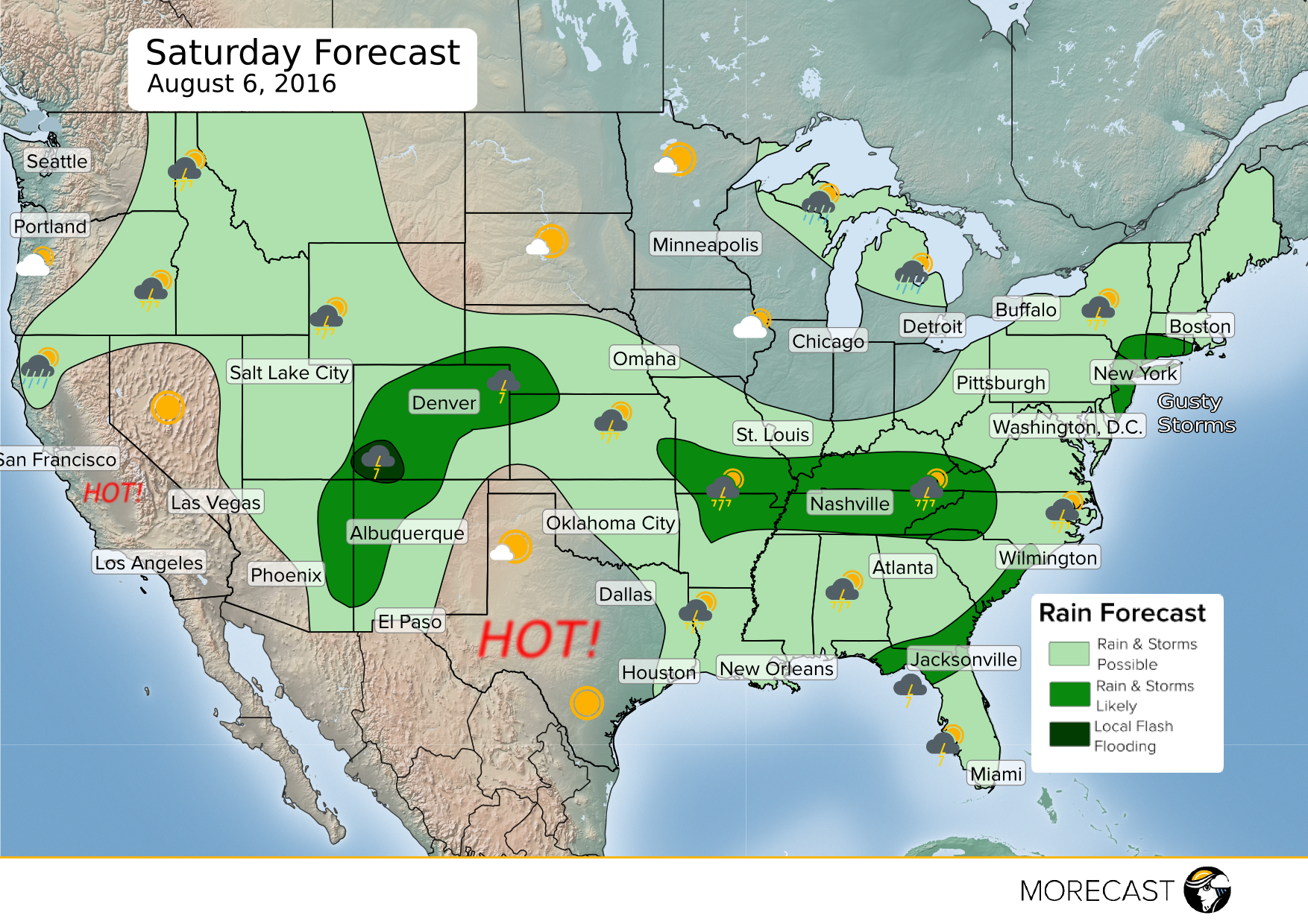
That same front will extend all the way back into the Ohio & Tennessee Valleys as well as the Great Plains as it slowly drifts south, providing a focal point for more scattered storms for both Saturday and Sunday. Along with some gusty winds, some of these storms will produce downpours, with a threat for isolated flash flooding.
Beach goers in the Gulf Coast, Carolinas and Florida will also have to be alert for some hit and miss storms. A stretch from Tampa Bay to Panama Beach, Florida could be a washout for the weekend, as a slow moving system will bring nearly persistent rain and thunderstorms to the area.
The summer monsoon will continue across parts of the Desert Southwest up into the Rockies this weekend, bringing more thunderstorms to a region that has been active for several days now. Localized heavy rain will be possible, especially across the San Juan Mountains in southwest Colorado on Saturday. Those hiking in the high country this weekend should be on alert, as both flash flooding and lightning produced by any storms will be a threat.
Some pop up storms are also expected across the Great Basin and Northern Rockies with a few showers in the Pacific Northwest as an upper level system moves in from the Pacific Ocean. Areas of western Montana are expected to receive heavy rain on Sunday.
The hot spots this weekend will be Texas, Oklahoma, the deserts of Arizona, Nevada and California as well as the Golden State’s Central Valley, where the mercury will reach the upper 90s and triple digits. It won’t be as hot in Southern California around Los Angeles and San Diego, with highs only in the 70s and low 80s, although fog from the marine layer will lead to reduced visibilities, especially during the a.m. hours.