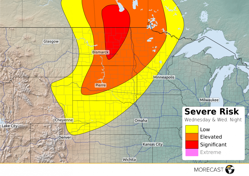
Low pressure will organize and track northeastward from northeast Montana to southern Manitoba Wednesday afternoon and night bringing a high likelihood of severe storms across the Dakotas and parts of Minnesota.
Large hail over 2.0 inches in diameter and damaging winds in excess of 60 mph are the primary threats from the strongest storms; however, a couple of tornadoes cannot be ruled out particularly within the red “Significant” risk area.
Surface temperatures Wednesday afternoon will soar well into the 80s to lower 90s across the northern Plains along with dew points approaching the lower 70s. As the afternoon progresses, a cold front will shift eastward from Montana into a very unstable airmass across the Dakotas. Consequently, strong to severe storms are expected to erupt after 4 pm and continue into the evening hours.
Initially, descrete cells that develop will have some potential to rotate and produce a tornado, primarily across North Dakota. By this evening, storms will likely congeal into one or more clusters of storms capeable of damaging wind and large hail. Storms will track into western Minnesota overnight and gradually lose their punch