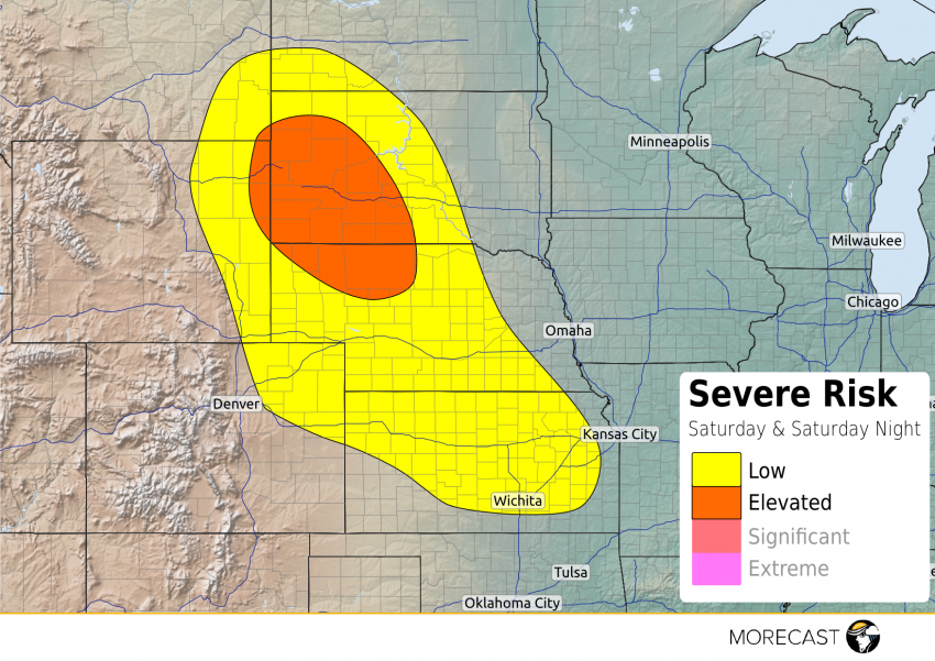
A day after severe thunderstorms brought baseball-sized hail to the town of Custer, South Dakota, additional severe thunderstorms capable of large hail are possible around the Black Hills again Saturday afternoon and early evening.
Daytime heating will generate moderate amounts of instability that will aid in the development of isolated to scattered thunderstorms after 3pm this afternoon. A brisk westerly flow 20,000 to 30,000 feet up combined with a light southerly surface wind will generate a moderate amount of wind shear over the north-central High Plains creating an environment that is once again conducive to large hail. Similarly to Friday, the strongest storms will have the potential to produce hail between golf ball and baseball sized.
The threat for storms over the High Plains will diminish after 10 pm, local time.
Farther south, scattered thunderstorms are expected to develop across Kansas this evening and continue into the overnight hours. Locally strong winds are possible within any storm, but widespread severe weather is not anticipated.