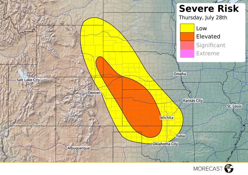
Large hail, strong wind gusts and isolated tornadoes are expected across the Plains this afternoon into evening.
A mid-level shortwave starts moving through the risk area today into tonight which will be the main forcing mechanism. An area of low pressure will develop at the border of Colorado, Nebraska and Kansas. Previous storms in north-western Nebraska will stabilize the area causing a decrease for strong storms to develop there but there is still potential for isolated severe weather to occur. Up-sloping along the Rockies with ample moisture and instability will help trigger storms this afternoon, this is the main area with the greatest potential for storms and tornadoes. Also, a low-level jet could pull a cluster of storms into western Kansas later tonight with the main threats of hail and wind.
Stay up to date through our Facebook and Twitter pages. Be sure to download the MORECAST app for hour by hour forecasts and post any storm related photos when conditions are safe!