The hot and humid weather from southern New England through the mid-Atlantic over the last several days will give way to a risk of severe thunderstorms and heavy rain.
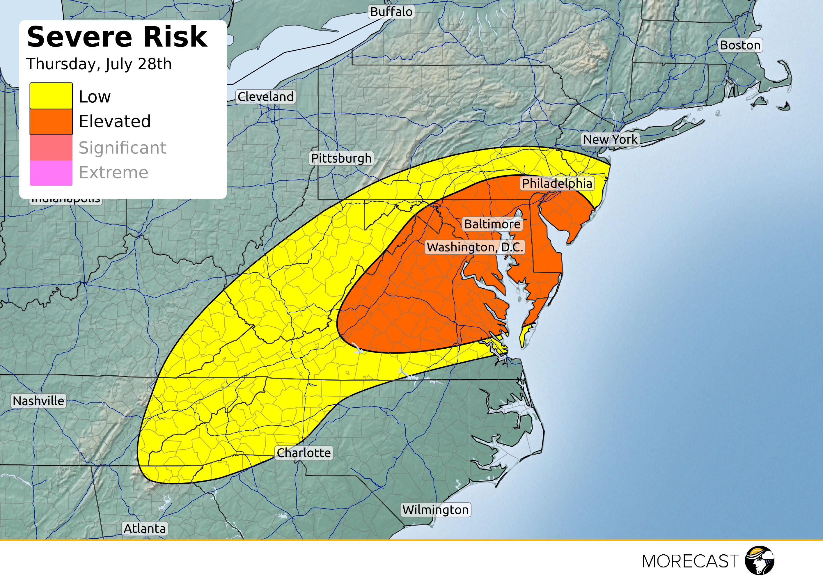
An area of low pressure will develop across Virginia late in the day Thursday and track toward the northeast through Friday. Accompanying the low will be the risk for severe thunderstorms Thursday afternoon and evening as well as the threat for heavy rain and flash flooding through Friday.
Severe Thunderstorm Risk: Ample moisture and instability ahead of the front and along a surface trough will be enough to trigger scattered storms in the risk area Thursday afternoon. Decent shear is also present which would pose a threat for strong winds to occur in the severe storms. Winds will be the main threat but isolated small hail could also be present.
Scattered showers will start around 1-2 pm Thursday in Washington D.C and Baltimore with the more severe storms moving in around rush hour. The evening commute could see flash flooding across road ways which could cause an even more slowed down commute.
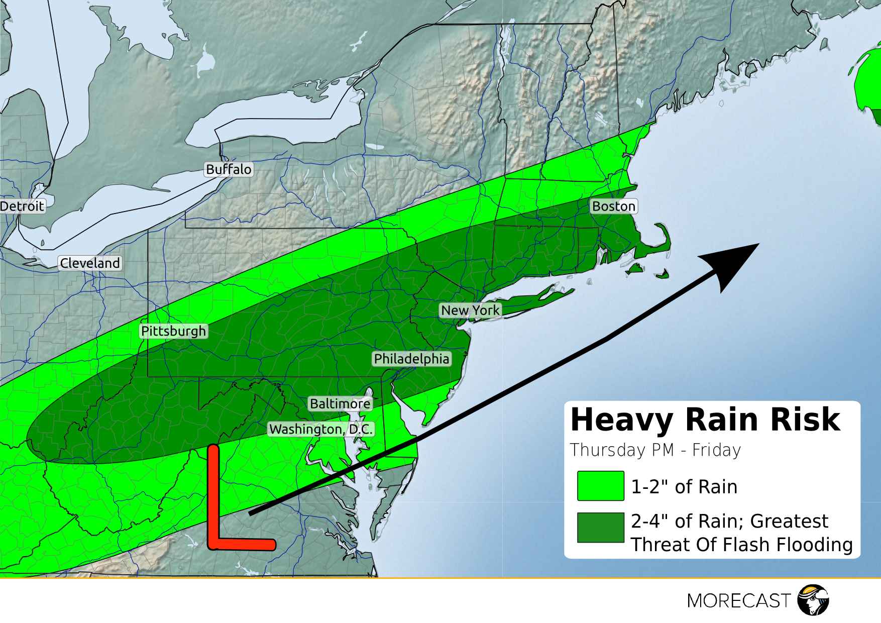
Heavy Rain & Flash Flooding Risk:
Low pressure will develop over central Virginia late Thursday and track towards the southeast New England coast by late Friday. Along and to the north of the low track, heavy rain and flash flooding producing thunderstorms are expected from the central Appalachians and northern mid-Atlantic tonight up through southern New England on Friday.
The heaviest rain looks to set up from northern West Virginia northeastward through Pennsylvania and southern New England. The densely populated I-95 corridor from Baltimore, MD up through New York City and Boston, MA will be at risk for 2-4 inches of rain over an 8-12 hour period of time. The potential exists for heavy rain and flash flooding to impede the Friday morning commute in Philadelphia and New York City. Flash flooding is a concern for these cities, particularly in poor drainage areas. Locally higher amounts of rain are possible in the heaviest storms and most persistent rain.