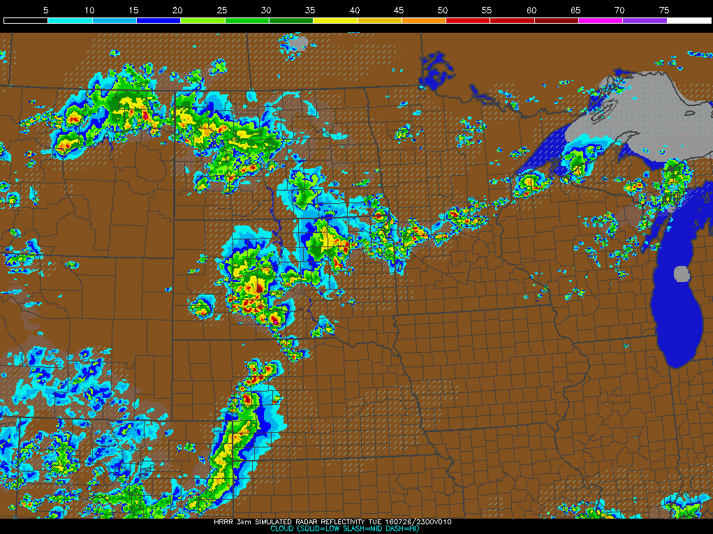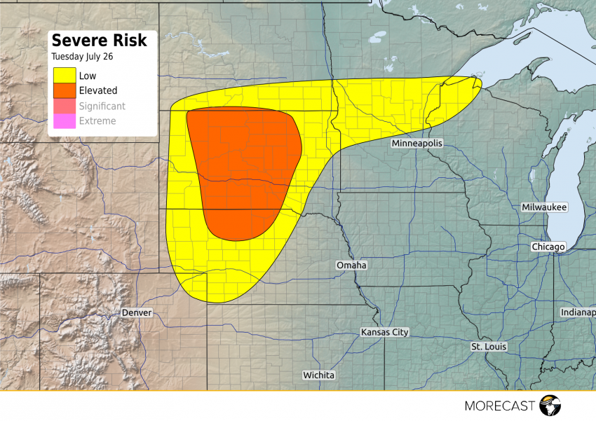
Widely scattered strong to severe storms are likely across portions of the Northern Plains Tuesday afternoon and evening, capable of producing damaging winds and large hail.
The heat and humidity will combine with an upper level disturbance to spawn the strong thunderstorms, with the main cluster of storms (and best severe chance) expected to develop along the North Dakota-South Dakota border before spreading east and south by Tuesday evening along the I-90 corridor into northern Nebraska. The primary threats will be damaging winds and hail up to 2″ in diameter. The tornado threat is relatively low, but an isolated twister is still possible.
Another narrow band of storms will also extend eastward into central Minnesota and northern Wisconsin. While conditions are not as favorable compared to the Dakotas and Nebraska, a few isolated severe storms will still be possible in these areas.
The severe threat in all areas will diminish after 10 p.m. CDT.