Threat of severe storms this afternoon and evening across the Northeastern US.
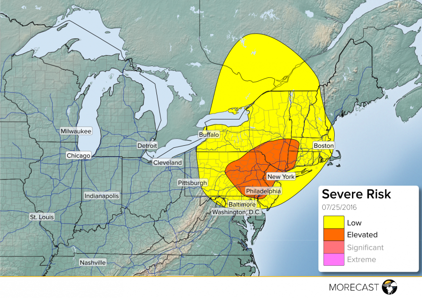
A warm front is moving through the region this morning, resulting in an increase in dew points. To the west, a cold front is moving through the Great Lakes. Ahead of the cold front, a trough axis will set up stretching from the Mid Atlantic up to Eastern New York/Western New England. With some current clearing and good upper level support, this will help initiate storms ahead of the cold front along the trough axis. The main hazards from these storms will include winds up to 65 mph, hail up to 1.5″, an isolated tornado, and localized flash flooding. The major metropolitans at risk include the Lehigh Valley, Philadelphia, New York City, and Poughkeepsie late afternoon into the evening.
Stay up to date through our Facebook and Twitter pages. Be sure to download the MORECAST app for hour by hour forecasts and post any storm related photos when conditions are safe!