Those looking for relief from the summertime heat will have limited options across the contiguous U.S. this week. The upcoming week’s weather pattern will be dominated by a jet stream that will largely remain across Canada and two ridges of high pressure; one across the Southwest U.S. and a second anchored off of the Southeast coast.
These areas of high pressure will aid in bringing above average temperatures to much of the Western U.S. as well as the Northeast, mid-Atlantic and Southeast.
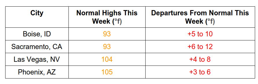
Western U.S.
Temperatures through the first three weeks in July have stayed near to a few degrees below average across the Pacific Northwest to around average or a few degrees above across the Southwest.
Through the rest of this week, high pressure will park itself over the Four Corners allowing most of the Western U.S. to soar above average by 5 to as much as 25 degrees in the most extreme cases.
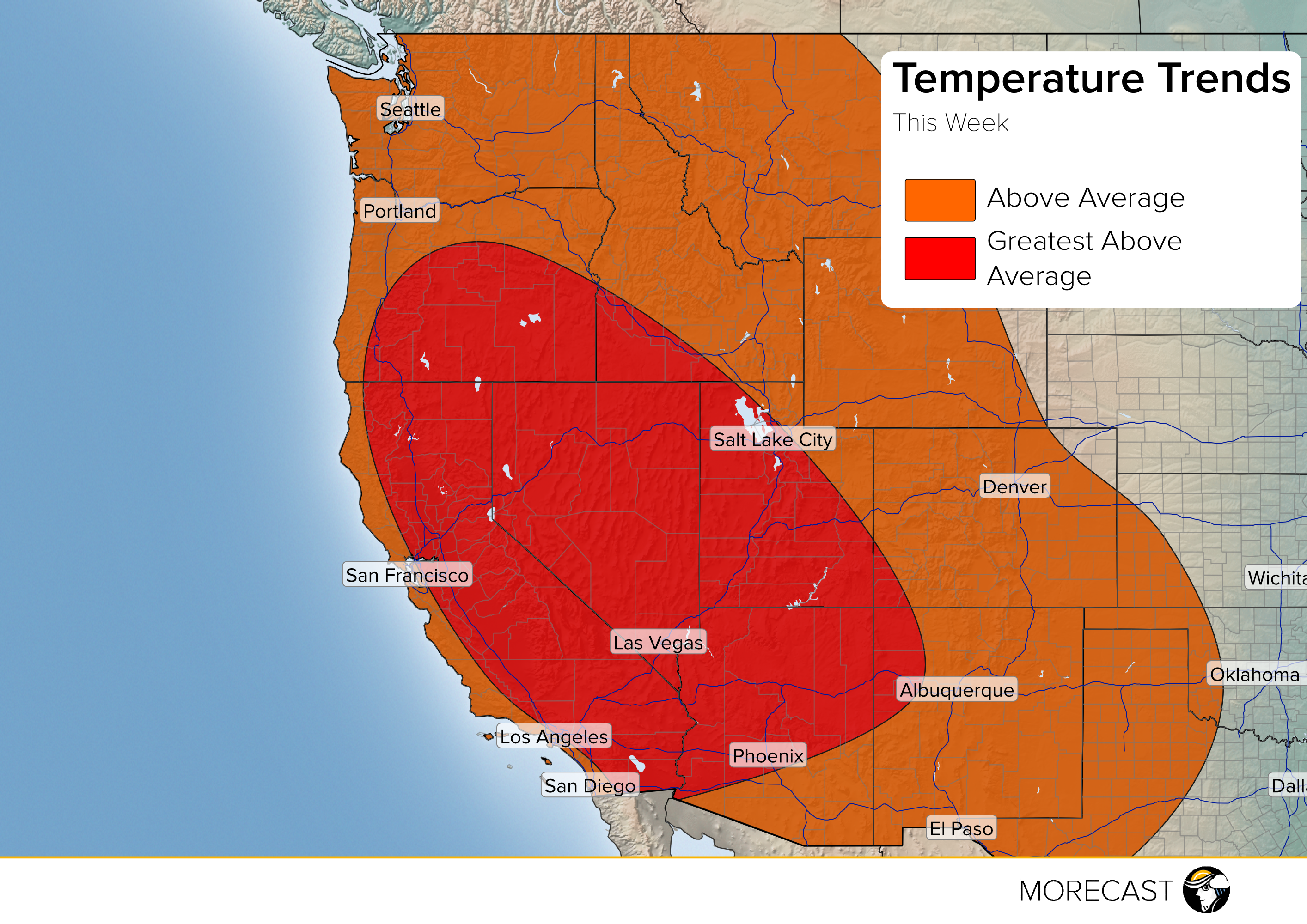
The highest temperatures compared to average will exist from interior Oregon and southern Idaho to points south through California and the Desert Southwest.
Temperature Data for Thursday-Friday, July 28-29th
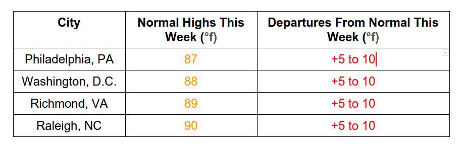
Eastern U.S.
Temperatures through the first three weeks in July have largely been near to a few degrees above normal from the Northeast southward through the mid-Atlantic and into the Southeast.
For the rest of the week, temperature departures for late July are expected to increase farther above normal.
High pressure is anchored just off of the Southeast coast allowing most of the eastern seaboard to soar a good 5-15°F above average.
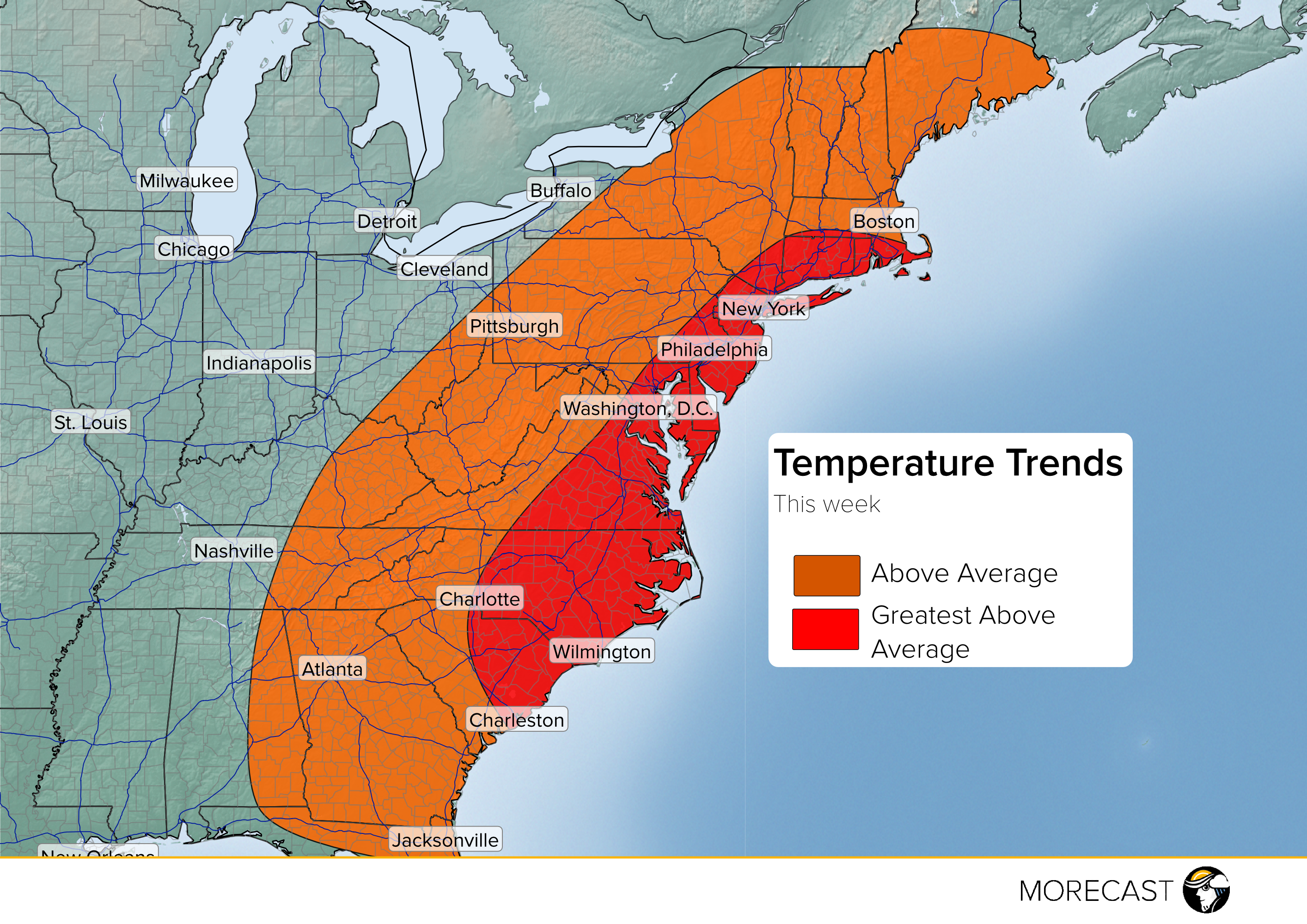
The hottest temperatures compared to normal will extend from the mid-Atlantic southward to the Carolinas.
Temperature Data for Thursday-Friday, July 28-29th