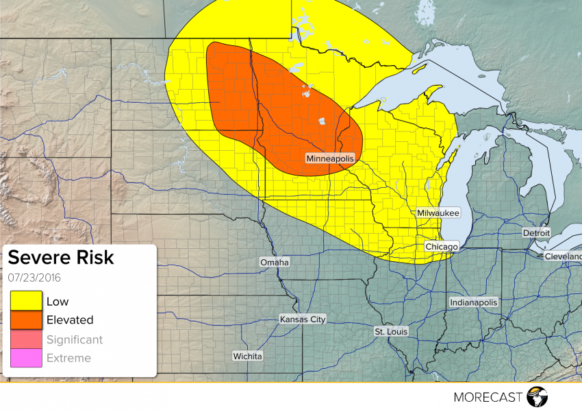
Threat of severe weather through this evening/overnight across parts of the Northern Plains and Upper Midwest.
A storm system will move through parts of the Northern Plains and Upper Midwest today. Warm front will move through Eastern South-North Dakota, Minnesota, and Western Wisconsin during the day into the overnight. This will be associated with a threat of some storms late morning into the afternoon. A cold front will move in from west across the Dakotas. Ahead of the cold front, some good upper level support will help initiate storms during the early afternoon across Eastern North Dakota and South Dakota. These storms will move east along the warm front into Minnesota late afternoon and evening.
The main hazards will include wind gusts up to 70 mph, hail up to 2″, isolated tornadoes, and localized flash flooding. The major cities at risk include Fargo, ND; St. Cloud, MN; and Minneapolis-St. Paul, MN.
Stay up to date through our Facebook and Twitter pages. Be sure to download the MORECAST app for hour by hour forecasts and post any storm related photos when conditions are safe!