Severe weather will be possible across portions of the Northern Plains today. Areas are at risk for strong gusty winds, large hail, and isolated tornadoes.
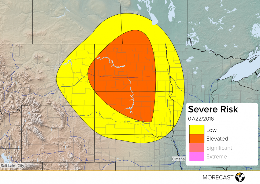
Warm weather continues across a majority of the US but that also means in some portions of the country an increased risk of severe weather. Up in the Northern Plains, severe weather is possible across portions of eastern Montana and the Dakotas as well as southern parts of Saskatchewan and Manitoba; including the cities of Minot and Bismarck, North Dakota. The severe threats will include strong wind gusts up to 70 mph, large hail up to 2 inches in diameter, and isolated tornadoes. A majority of North Dakota as well as north central South Dakota have the greatest risk. Storms should begin to develop in the early afternoon and last throughout the late evening and overnight hours.
Stay up to date through our Facebook and Twitter pages. Be sure to download the MORECAST app for hour by hour forecasts and post any storm related photos when conditions are safe!