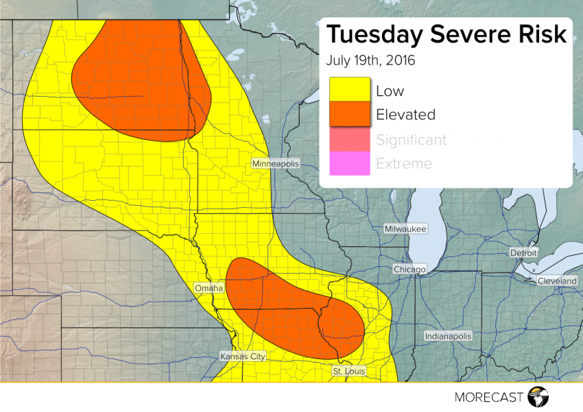
There will be two potential areas of severe storm escalation this afternoon into tonight, one from southern Iowa into northern Missouri and western Illinois, the other mostly in North Dakota and northwestern Minnesota. Dangerously high winds, large hail, and possibly a tornado or two will occur.
Instability is building across this region. Although the trigger mechanism is not clearly defined, there exists a strong potential for clusters of severe storms to form in the “Elevated” regions depicted, accompanied by widespread damaging winds and large hail to 2″ in diameter. The tornado threat is low, but one or two can’t be ruled out of the question. The severe threat in eastern North Dakota and northwestern Minnesota will linger well into the overnight hours.
Keep an eye on our social media feeds (Facebook and Twitter) for the latest information.