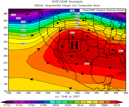
Before getting into the North American Monsoon (NAM), it’s important to understand what a true monsoon really is. The definition is a seasonal shift in winds that causes a drastic change in weather to occur (mostly changes in rainfall amounts). There’s some controversy as to whether the NAM is actually considered a true monsoon because the seasonal shift in winds is not very pronounced compared to other monsoons in the world. The NAM is proven through various studies that it is indeed a monsoon because during the season there is a drastic increase of rainfall over Mexico and the Southwestern United States due to the not so pronounced wind shifts. The increase in rainfall over these desert areas are due to the intense solar heating that results in an area of thermal low pressure to form. This causes the flow from dry land areas to reverse to be from moist ocean areas. The lower atmosphere moisture is mostly transported from the Gulf of California while the upper atmosphere receives its moisture from the Gulf of Mexico. A mid atmospheric high pressure ridge over the Southwest is what brings in the moisture from the Gulf of Mexico which can be seen below in Figure 1. The location and strength of this ridge is important to distinguish the location and how far north the thunderstorms will occur.
Monsoon Surges:
The monsoon gets pushed into the SW United States due to surges of tropical moisture that push northward along the Gulf of California. These surges are due to various large-scale atmospheric patterns. The stronger and deeper the surge, the better for thunderstorm development in Arizona. Once the moisture hits the SW, the orographic lift and intense surface heating causes thunderstorms to pop up in the area.
Active Monsoon Days:
It is important to note that the rainfall associated with the monsoon is not continuous; the NAM has “active” and “break” periods throughout the season. Typically after a very active day of severe thunderstorms a break period of little to no rain may occur in the area. For these locations, the NAM is the main source of yearly rainfall so it is very important for the monsoon to come but it can be very dangerous because it brings intense flash floods, lightning strikes, winds, and blowing dust.
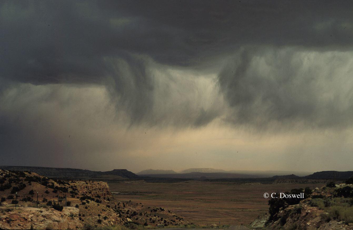
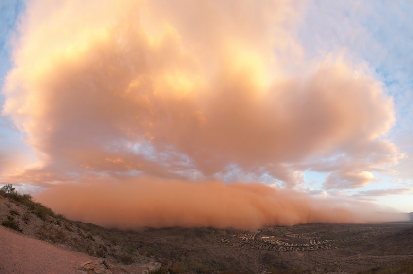
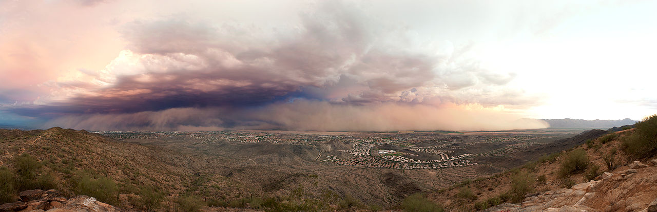
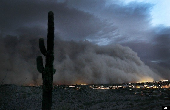
On an active monsoon day, afternoon thunderstorms develop over the mountains and move down into the valleys in the evening. Sometimes the valleys remain very dry, so when storms move off the mountains, the rain may never reach the ground. This is called virga; you can see the streak of rain falling but it evaporates before it hits the surface (see image above). The low level dryness could result in downbursts and dust storms to occur which can be very dangerous (see both images below). Rain and storms dwindle at night as these storms are driven by the sun’s daytime heating.