After experiencing mostly sunny and mild conditions to start the working week, people across New South Wales will once again need their umbrella’s at the ready. Rain is set to increase Tuesday evening and last throughout Wednesday.
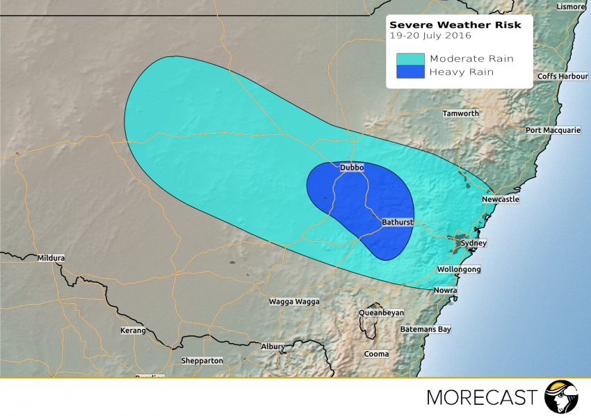
A highly moist tropical air-mass will be pulled down across the state and combine with an upper level disturbance. Present indications suggest the resulting rain band will deliver 20-40mm of rain across most of the central interior and eastern coastal regions of NSW.
The heaviest falls look to be focused on parts of the Central Tablelands and the Central West Slopes & Plains, where up to 60mm of rain is not out of the question. It is possible that some locations in this region match their monthly average rainfall for July in just a 24hr period!
The heaviest of the rain is forecast to ease late Wednesday evening, however, light showers will persist into Thursday.
Check the free MORECAST App for your detailed forecast.