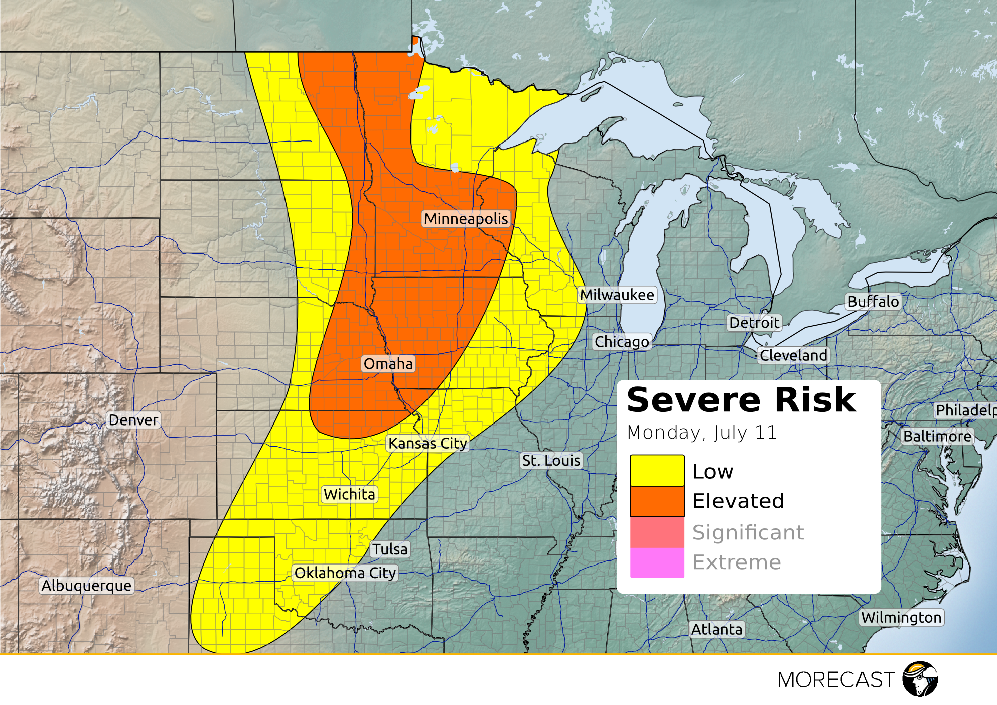
A cold front will be pushing through the High plains into the Midwest which will trigger severe weather across the area this afternoon into evening.
There’s currently residue from an overnight squall moving through Minnesota which will have potential to regenerate into new storms. Ample instability and moisture is present through out the areas with very warm temperatures; this will contribute greatly to the development of storms along the front. The main threat across the ‘elevated’ region is strong wind gusts up to 65 mph, large hail up to 1.5″ and an isolated tornado or two is not out of the question. The area that could possibly see an isolated tornado is east central Minnesota; this is just south of where a new low is created from the triple point (where a cold, warm and occluded front meet).
MORECAST meteorologists will continue to issue forecast updates for the severe storm threat through this afternoon and evening, available on Facebook, Twitter, and the MORECAST app!
