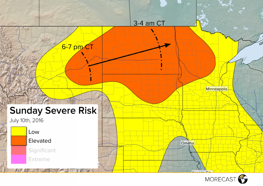
Conditions will become ripe for severe storm development later Sunday afternoon into the evening. A squall line of severe storms will likely develop this evening in eastern Montana and sprint across North Dakota tonight. Very large hail, isolated tornadoes, and strong winds will all be threats late this afternoon into this evening, with damaging straight-line winds becoming the predominant hazard overnight.
Warm temperatures and rich moisture will combine to create a highly unstable atmosphere over the Plains this afternoon. Meanwhile, a large upper-level trough will start to encroach on the Northern Plains later today into tonight, sparking severe storm development. Watch for hail up to three inches in diameter, wind gusts to 80 mph, and a few isolated tornadoes. The severe threat by early Monday morning will be concentrated along a squall line moving east-northeast towards the Minnesota-North Dakota border.
We’ll continue to issue forecast updates for this imminent severe storm threat through this afternoon, available on Facebook, Twitter, and the MORECAST app!
