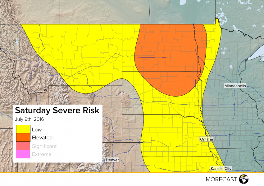
Strong to severe storms are expected later Saturday afternoon into the overnight especially from central and eastern North Dakota into northern South Dakota and eventually far western Minnesota. High winds, large hail, and potentially a tornado or two will accompany these dangerous storms.
A narrow ribbon of high instability will build up through the Northern Plains later today, eventually aligning with strengthening upper level winds to produce a favorable environment for severe storms to develop. These storms will likely form over the central Dakotas in the mid-afternoon and spread east and southeast into this evening. Wind gusts to 70 mph, large hail to two inches in diameter, and a couple of isolated tornadoes will occur. Storms in eastern Montana as well as further south into the Central Plains will be capable of producing gusty winds or large hail in a few cases, but overall the threat there for organized, long-lasting severe storms is much lower.
Keep informed by following us on Twitter and Facebook, and by consulting the MORECAST app!
