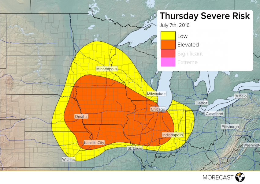
One dangerous squall line of severe storms will be moving from Iowa into Illinois on Thursday. Another round of scattered strong to severe storms will fire up by the afternoon behind and to the south of this initial squall line. Dangerously high straight-line winds and localized flash flooding will be concerns throughout the day with severe cells. Very large hail and isolated tornadoes will also occur in the afternoon and evening hours.
The pattern of severe storm complexes moving generally west to east will continue on Thursday. One overnight squall line will move from western Iowa early in the morning to the Illinois-Indiana border by early to mid-afternoon. Damaging winds will be likely throughout the life span of this squall line. By afternoon, instability will likely have built back in behind this squall line, allowing for redevelopment of severe cells accompanied by very large hail to 2.5″ in diameter and isolated tornadoes. We’ll send an update early Thursday morning in which we could upgrade a portion of this area to a SIGNIFICANT RISK.
Stay on top of the latest severe weather trends and other interesting weather items by following us on Facebook and Twitter!
