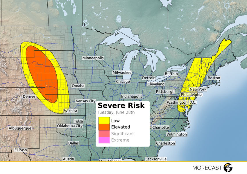
Storms are expected to fire up this afternoon from southeastern Montana to northeastern Kansas. Large hail up to 2 inches and damaging winds to 60 mph are the main hazards. There is also potential for a few isolated tornadoes across the ‘elevated’ region. These storms will move towards the south and southeast through the afternoon to the evening when diurnal heating is at its maximum.
Also a low pressure over southern Quebec has a cold front that is draping down along the Northeast with an associated shortwave trough aloft. Severe storms are probable along this cold front with the main threats being strong winds and hail. Storms start triggering along the cold front this afternoon at around 1 p.m. EDT and continue through the evening.
Check out the MORECAST app as well as our social media outlets. Stay tuned!
