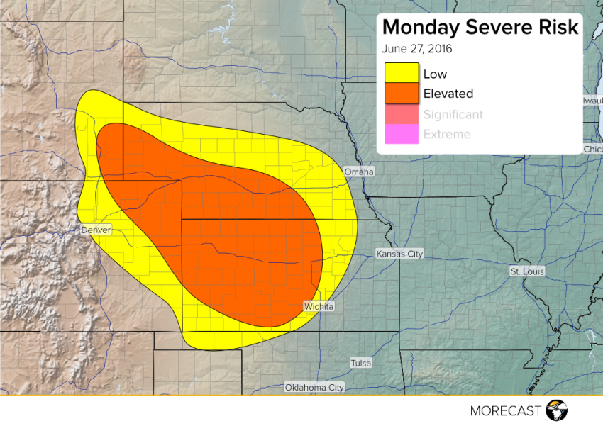
Some widely scattered strong to severe storms will fire up this afternoon from southeastern Wyoming and northeastern Colorado into much of Nebraska and Kansas. These storms will produce damaging wind gusts to 65 mph and large hail to 2 inches in diameter before they weaken overnight. An isolated tornado can’t be ruled out completely, but the threat is low.
Moisture will bank up against the mountains with marginally strong upper level winds providing enough of a catalyst to promote storm development by the afternoon hours. These storms will tend to move southeast into the lower Plains later in the afternoon into the evening. A squall line could even organize in the evening through west-central Kansas with a severe storm threat lingering late into the overnight hours.
Check out the MORECAST app as well as our social media outlets. Stay tuned!
