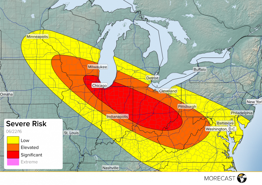
MORECAST meteorologists are forecasting a significant severe weather event on Wednesday, into Thursday.
Starting on Wednesday afternoon, strong storms will be possible for areas of Minnesota, Wisconsin, and Iowa. Potential exists for supercells that could turn tornadic, as well as produce damaging wind and large hail.
Later in the day, a more widespread event looks to fire up around the Chicago area. A line of storms with very strong winds is forecasted to push southeast from Chicago on Wednesday evening, with hail and embedded tornadoes also possible.
The line will move to the southeast across northern Indiana, reaching Ohio in the late hours of the day. As activity progresses through Ohio, storms will become more widespread and intense, perhaps taking on the characteristics of a derecho.
The most damaging potential will be at the leading edge of any bowing shapes in the line of storms. Most at risk will be areas inside our “significant” area, with sustained winds over 60 mph and gusts above 80 mph the primary threats.
Storms will continue to push southeast into West Virginia through the early hours of Thursday, though likely weakening. Activity may eventually reach the Mid-Atlantic after sunrise.
We will update our info and forecasts as we continue to get the latest data. Follow us on Twitter and stay up to date!
