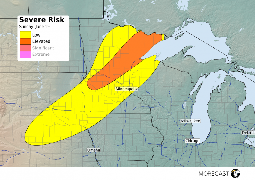
A cold front will be moving through portions of the Upper Midwest late Father’s Day, bringing the risk for severe weather to the region.
Most of the early and mid afternoon hours Sunday will be quiet, though it will be warm and muggy. The hot and humid air will provide the fuel for thunderstorms to develop rapidly ahead of a cold front after 5 p.m. CDT. The strongest storms are expected in the Elevated Risk area across central and northeast Minnesota, including Duluth along with eastern South Dakota (just north of Sioux Falls). These storms will be capable of producing damaging winds, large hail up to 2.5″ and heavy rain. A few tornadoes will also be possible, with the most favorable conditions for a twister in the lakes area of Minnesota.
Additional storms will form along a broken line back into northern Nebraska, although these storms will be more hit and miss in nature with less of a tornado threat (damaging winds and heavy rain will be the primary risk).
The line of showers and storms will gradually move south and east through the evening into the Twin Cities after sunset, but will be gradually weakening with the loss of daytime heating. So while a severe storm cannot be entirely ruled out, the risk is low for the Minneapolis/St. Paul metro area, with most just seeing some regular showers and thunderstorms.
