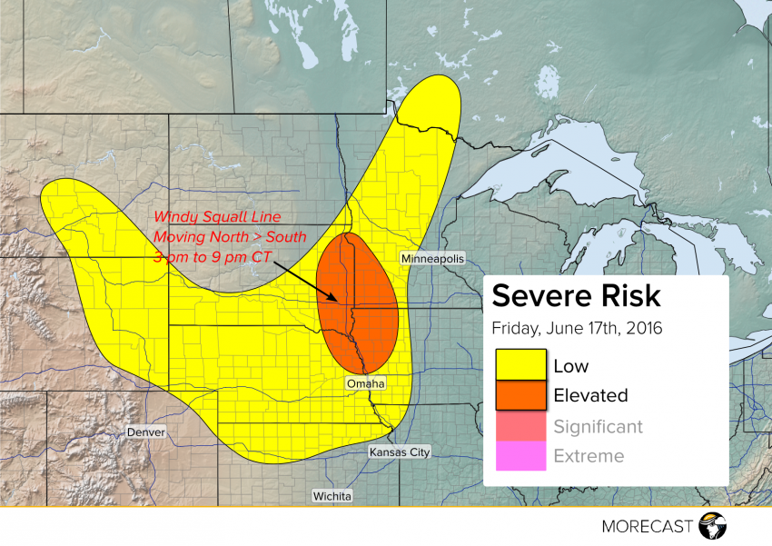
The outflow from a morning squall line in the Northern Plains will spark severe storm development Friday afternoon. The most organized threat for damaging winds is expected along the Missouri River from eastern South Dakota and southwestern Minnesota into northeastern Nebraska and northwestern Iowa from mid-afternoon through early evening.
The atmosphere today in the Plains is characterized by very warm temperatures with a high degree of instability. While there isn’t much in the way of an upper-level disturbance to help storms develop, an outflow boundary thrown off by a severe squall line that has moved across North Dakota and Minnesota this morning will provide enough of a trigger for severe storms by mid-afternoon, starting along the Minnesota-South Dakota border and moving south-southeast. Other, less organized strong to severe storms are expected in the High Plains, capable of isolated cases of large hail or high winds. The tornado threat today is negligible.
We’ll be tracking severe weather and sending updates and reports as needed through tonight over Facebook and Twitter. Share pictures of weather in your area with the global MORECAST community using our app!
