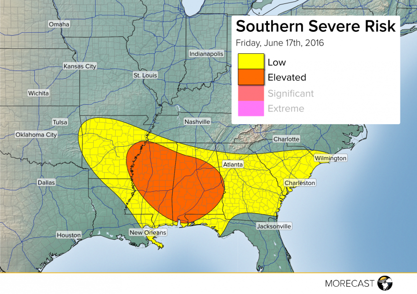
Hot temperatures and plentiful moisture combined with an approaching front will spark widespread storm development Friday afternoon across the South. Some of these storms will be severe, capable of producing damaging wind gusts, with the most organized threat in Mississippi and Alabama.
A highly charged atmosphere exists across the Mid-South early this Friday afternoon. Although upper-level winds are rather weak, a surface front moving into this highly unstable situation should provide a trigger for numerous storms to develop through the early evening hours. These storms will likely produce significant wind damage over some areas, including power outages, especially in Mississippi and Alabama. Once the sun sets, the atmospheric energy needed to maintain storms will diminish, and they should weaken gradually after mid-evening. Hail will be a less widespread concern, although a few big stones aren’t out of the question. Flash flooding could also be a localized hazard. The tornado threat in this area is negligible, fortunately.
We’ll keep issuing updates as needed on this developing severe weather situation via Facebook and Twitter. Post pictures when you can for the global MORECAST community to enjoy using our app!
