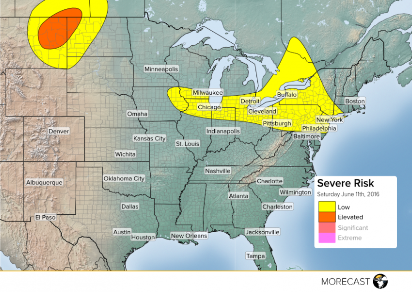
Saturday will bring another active severe weather day across portions of the U.S.
A warm front will lift through the Northeast and that will bring the chance for scattered showers and thunderstorms for the morning and afternoon. Some of the storms could become severe during the afternoon across central and northern Pennsylvania, New York and New Jersey. Philadelphia and New York City could see some storms capable of strong winds and hail.
A cold front will be making its way through the Great Lakes region and that will kick off scattered t-storms during the afternoon and evening for cities like Chicago, Milwaukee and Detroit. Temperates ahead of the front will warm into the upper 80’s to mid 90’s leading to plenty of energy in the atmosphere to see strong to severe storms. Wind and hail will be the main concern with any of the stronger storms.
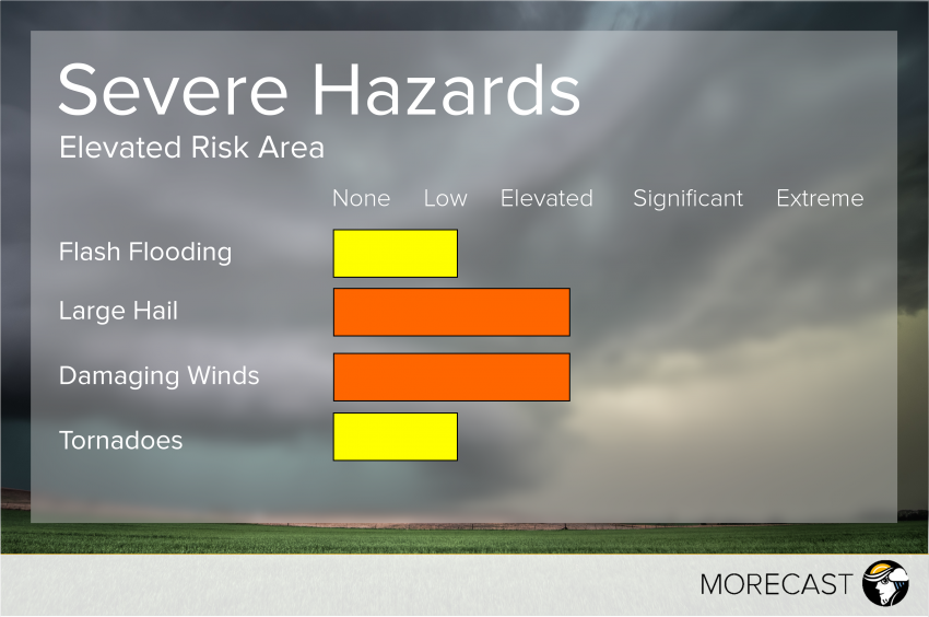
A low pressure system tracking to the northeast will push a warm front into the northern plains Saturday afternoon. The atmosphere will destabilize during the afternoon across North Dakota into eastern Montana and we will see scattered t-storms develop during the early evening. Storms early on will carry a threat for tornadoes, hail and wind but as the evening goes on thunderstorms will grow upscale and carry mainly a wind and hail threat.
Stay safe and follow Morecast on Twitter and Facebook for further updates. Follow @MORECAST_USA


