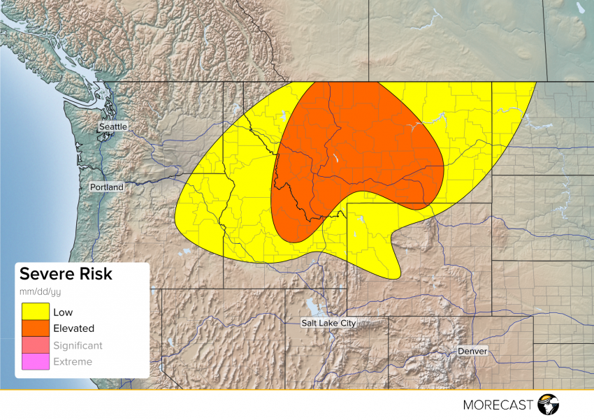
A low-level jet streak will punch into the Interior Northwest on Wednesday afternoon, helping to fire strong storms across large portions of the region. With clear skies over most of Montana and Idaho, temperatures will rapidly heat heat up during the late morning/early afternoon. Daytime heating combined with favorably cool temperatures and strong winds not far above the surface will favor strong storms for a large portion of the Northern Rockies.
Damaging wind and hail will be the primary threats west of I-15, with high based supercells probable over the high terrain (get the camera out if you’re in a safe spot!). As storms move down off the mountains, cells may merge together and track eastward through the evening. Strong wind will accompany the most potent cells.
Heading outdoors today? Don’t get caught out after the beautiful morning weather – check your MORECAST app for the latest information!
