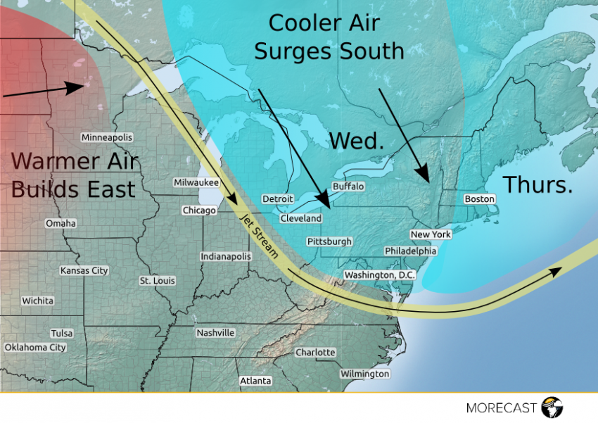
A dip in the jet stream across the eastern Great Lakes and the Northeast will open the door to a cool and blustery Canadian air mass that will bring a noticeable drop in temperatures to the area Wednesday and Thursday. Some will likely consider bringing along a sweater or light jacket on the way to work.
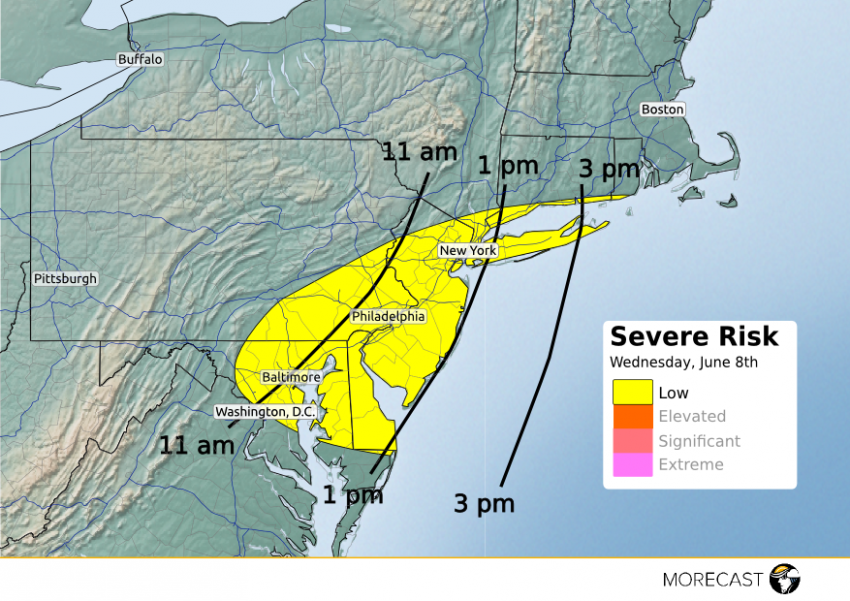
A disturbance responsible for the cooler weather will cross the Northeast on Wednesday spreading clouds, gusty showers and thunderstorms along the I-95 corridor from Washington, D.C. to New York City and Boston. The strongest showers and storms could contain strong wind gusts over 40 mph and even small hail. The threat for storms will end by the early evening hours on Wednesday.
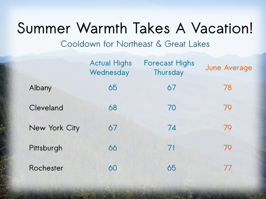
Temperatures will struggle to touch 60°F in some communities across the interior Northeast which is about 20°F below average for June. Additionally, the disturbance will bring gusty winds making it feel even cooler than the actual air temperatures.
The coolest air will shift slightly eastward on Thursday into eastern New England and parts of Quebec which will allow temperatures to rebound some farther west in states like New York and Pennsylvania. However, a strong storm moving through Atlantic Canada will keep winds brisk through Thursday.


