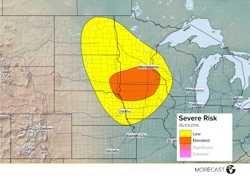
The atmosphere will be ideal for supporting severe storms later today across parts of the Northern Plains ahead of a cold front. The setup of an upper level jet overhead, upper level low over eastern North Dakota-western Minnesota, trough axis over the Red River Valley, and a 850 jet that will develop later in the day will help make the environment enriched for possible storm development. Currently, breaks in the clouds across eastern South Dakota and North Dakota will help initialize storms this afternoon. As you move further east towards Wisconsin, the atmosphere might not have enough time to recover from the clouds and rain that occurred earlier with a warm front.
The main hazards with these storms will include winds up to 65 mph, hail up to 2″, isolated tornadoes, and localized flash flooding. Be sure to look at the weather before you head back home from work or have any outdoor activities/ dinners planned in these locations.
Stay up to date as the storms develop by following along with MORECAST on TwitterFollow @MORECAST_USA and Facebook and be sure to upload any pictures you can safely to your MORECAST app.
