Over the past week, a substantial amount of rain has fallen across central and southeastern Texas leaving homes, roadways, and buildings flooded. Rain will continue to fall from central and eastern Texas over into Louisiana through Saturday.
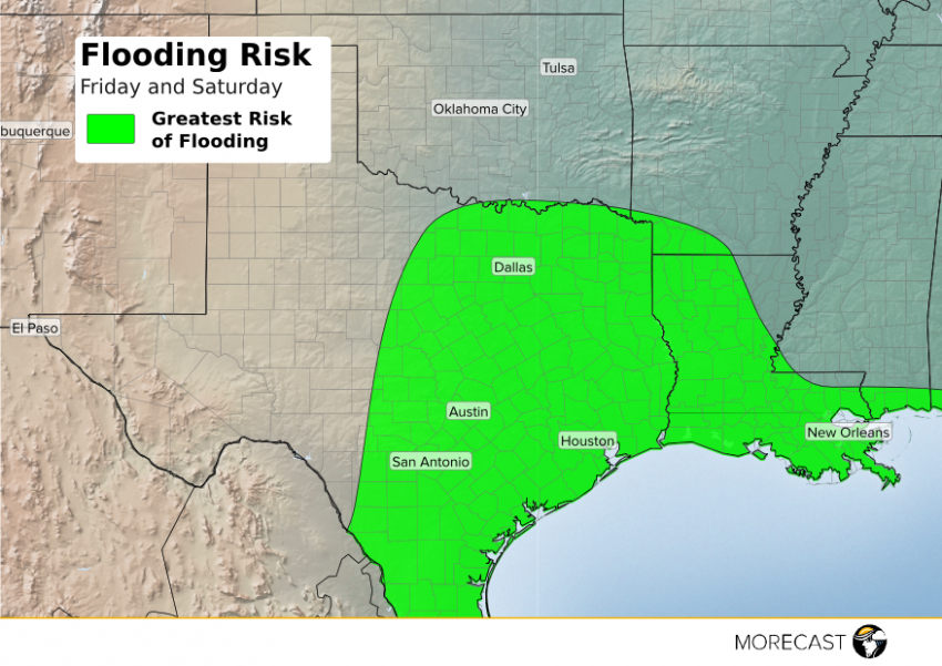
A disturbance moving slowly across Texas will result in additional drenching showers and thunderstorms on Friday. Isolated showers will become more widespread across Texas and Louisiana throughout the day and into the evening hours. The threat for widespread rain will gradually diminish over the weekend as the disturbance responsible sinks southward and weakens. An additional 1-3 inches can be seen over most of the outlined area above, with locally higher amounts along the I-10 corridor east of Houston to Beaumont, Texas, and Lake Charles, Louisiana.
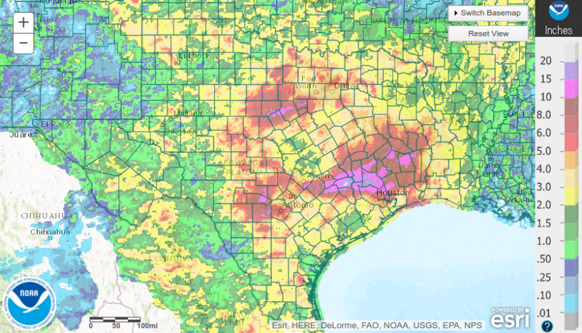
The image below shows total radar estimated rainfall amounts across the southern Plains since May 27th. Areas just north of Houston have been hit the hardest over the last week with radar estimated rain totals of up to near 20 inches. Other locations southwest of Dallas have seen 7-day rainfall totals of 8-12 inches.

The risk for flooding is amplified along rivers. The Brazos River in the Houston area reached a record breaking flood stage of 54.81 feet, which is over 4 feet higher than the previous record of 50.30 feet set back on October 21st, 1994. If you see a flooded road DO NOT drive across it, turn around. It is very hard to tell how deep the water might be and sometimes the water could be moving very fast.
MORECAST meteorologist will continue to issue updates as the flooding continues over the next few days on Twitter and Facebook.
