What a month of May it was across the U.S. There were widespread severe events; the tropics come to life a little early; and the continued demise of what was once one of the strongest El Ninos on record. MORECAST has a look back at three of the biggest weather headlines in May.
Severe Storms
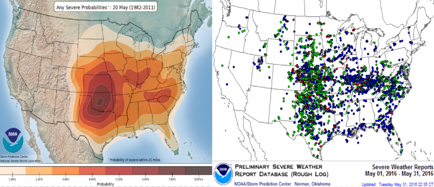
When it comes to severe thunderstorms, May 2016 turned out to be an active, but seasonable month. A total of 42 states had at least one severe weather report, which are storms that produce one of or a combination of the following: a tornado, one-inch diameter hail or larger, and damaging winds of 58 mph or higher. The highest concentration of severe weather reports were in the central and southern Great Plains, with another batch throughout much of the Ohio River Valley extending east into Appalachia in Virginia and North Carolina. These concentrations correspond quite well with the 30-year probabilities of the daily severe weather risk in the middle of May (see figure below).

When it comes to tornadoes, there were a total of 231 reported from 21 different states to the Storm Prediction Center (note: the 231 reports are considered preliminary and the total number of twisters for the month could be lowered, since the same tornado sometimes gets reported multiple times). Typically, the U.S. averages 276 tornadoes in May, meaning last month was actually a little below average for tornadic activity.
Here were the Top 5 States based on number of tornado reports:
| State | Tornado Reports: May 2016 | Avg. May Tornado Reports |
| Kansas | 59 | 38 (+21) |
| Texas | 50 | 43 (+7) |
| Colorado | 24 | 12 (+12) |
| Oklahoma | 23 | 28 (-5) |
| Nebraska | 16 | 17 (-1) |
| Kentucky | 16 | 6 (+10) |
There were also two violent EF4 tornadoes in May, one each in southern Oklahoma and central Kansas, with winds between 166 and 200 mph. These were the first twisters of 2016 to reach EF4 strength. So far in 2016, there have been approximately 556 total tornadoes nationwide, which isn’t too far off from the average of 575 tornadoes through the end of May. So to this point, it has been pretty typical year when it comes to severe storms.
Tropical Storm Bonnie

The Atlantic Hurricane Season didn’t officially start until June 1, but the tropics didn’t wait. After the extremely rare January hurricane with Alex in the eastern Atlantic, last month brought the first tropical activity of the year to the U.S. with the formation of Bonnie.
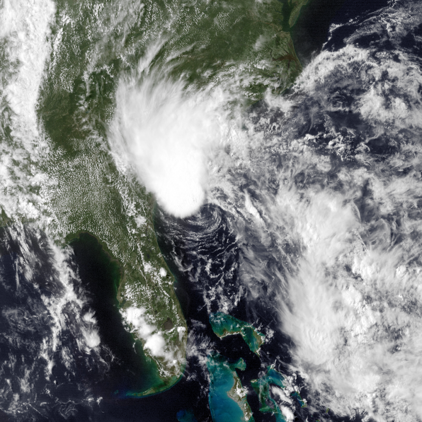
Bonnie became a tropical storm on May 28 off the southeast coast as it slowly made its way north towards South Carolina. The winds with Bonnie struggled to strengthen, maxing out at only 45 mph for a brief period of time. However, Bonnie was strong enough to create dangerous rip currents along the beaches of Florida and the Carolinas, which claimed the lives of two people.
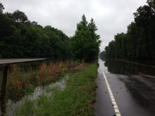
While Bonnie weakened back into a depression before making landfall near Charleston, South Carolina, the storm ended up stalling out, leading to several areas of heavy rain across the Southeast during the Memorial Day holiday weekend. Around Charleston, there were several reports of four to as much as ten inches of rain from Bonnie. Parts of North Carolina and eastern Georgia were also pounded by downpours. The rain was so heavy that officials in South Carolina had to shut down a flooded stretch of I-95 located just to the north of Savannah.

El Nino Ending

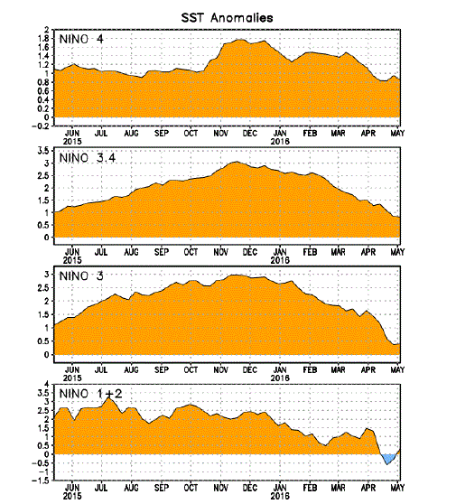
One of the major drivers of weather patterns around the world for the past year-and-a-half has been El Nino. And it wasn’t an ordinary El Nino, as this event will go down as one of the three strongest on record.
However, all signs are pointing to this El Nino phase coming to a rapid end. The above average sea surface temperatures in the central and eastern equatorial Pacific Ocean that make up El Nino have all shown signs of cooling off below levels needed to be classified as such. However, those required levels use averages over a three month period, so El Nino has not been officially declared over just yet, but it’s getting close. It’s expected the eastern Pacific and resulting atmospheric patterns will fully return to a neutral phase in the next couple of weeks.
This El Nino did have some positives, including increased rainfall for northern parts of drought-stricken California. But it also contributed to increased severe weather and heavy rains across the South during the winter and early spring. NOAA now predicts a 75% chance that El Nino’s counterpart, La Nina, will develop this fall. The immediate concern with that will be in California, as La Nina’s tend to favor below average precipitation in the Golden State, which could undo the improvements in the drought that occurred because of El Nino.