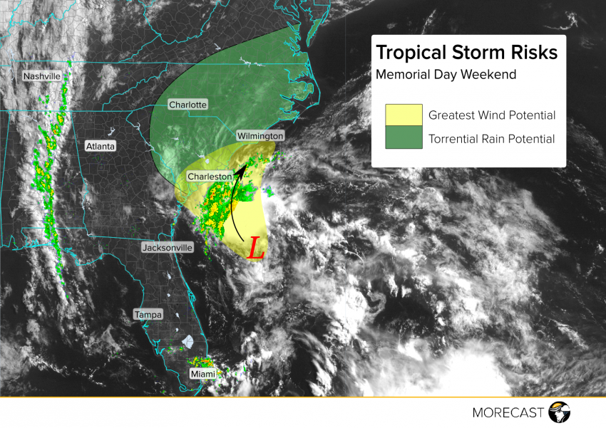
Tropical Depression 2 is drifting closer to the Gulf Stream that may provide enough of a punch to develop it into Tropical Storm Bonnie just in time to influence South Carolina. MORECAST meteorologists are watching the situation carefully as we head into the busy Memorial Day weekend.
The wind shear that has been hampering the deveopment of TD 2 has decayed which is allowing thunderstorms to develop closer to the center of circulation and will allow the storm to strengthen. What has been keeping the storm at bay over the last 48 hours is the relatively cool ocean temperature and the significant dry air surrounding it. Models are in agreement that the storm will drift slowly toward the northwest over the next couple days which will take it over the warmer Gulf Stream before interacting with land. This added punch of warm water will likely allow the storm to strengthen for a short period of time. We’re 80% confident that the depression will be upgraded to a low end tropical storm during the day Saturday. Landfall is expected near Charleston, but the storm will not venture too far inland before turning north and riding up the coast. Because of the marginal ocean temperatures and the dry air coming off the continent, at this time it still appears that rapid strengthening is highly unlikely and that Bonnie will not be a hurricane at landfall.
Even if the depression never intensifies beyond minimal tropical storm status, the coastal Carolinas will see significant impacts over the Memorial Day weekend. Bands of locally heavy, flooding rains and briefly gusty storms will move ashore starting later this afternoon and persist through Monday. High surf is also likely, leading to rip currents and hazardous swimming conditions for those visiting tourist hot spots like the Grand Strand and the Outer Banks. We’ll continue to issue updates as the situation evolves over the next few days on Twitter and Facebook.
