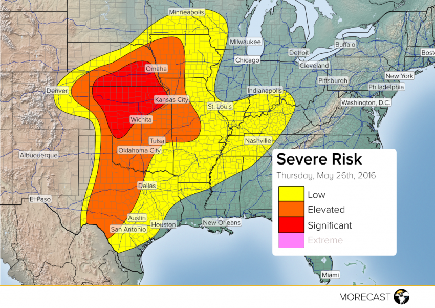
Another round of dangerous severe storms is expected this afternoon over portions of the Central and Southern Plains. The greatest risk for tornadoes, a few long-lived and strong, will be across portions of northern and central Kansas up into southern Nebraska starting early in the afternoon. Other storms with high winds and very large hail could affect Oklahoma and west-central Texas a bit later in the afternoon and evening.
Extreme instability will again build over the target zone thanks to the rich Gulf moisture that’s already in place combined with daytime heating. Meanwhile, an upper-level low pressure system moving out of the Southwest will provide the spark that will ignite severe storm development in the early afternoon, probably by around 1-2 pm CT. Severe storms will persist well into this evening, although the early hail and tornado threat will gradually give way to more widespread winds, hail, and flooding rains this evening.
Residents in the target area are advised to listen closely for messages over emergency broadcast channels. We’ll issue updates throughout the day and into tonight via Facebook and Twitter.
