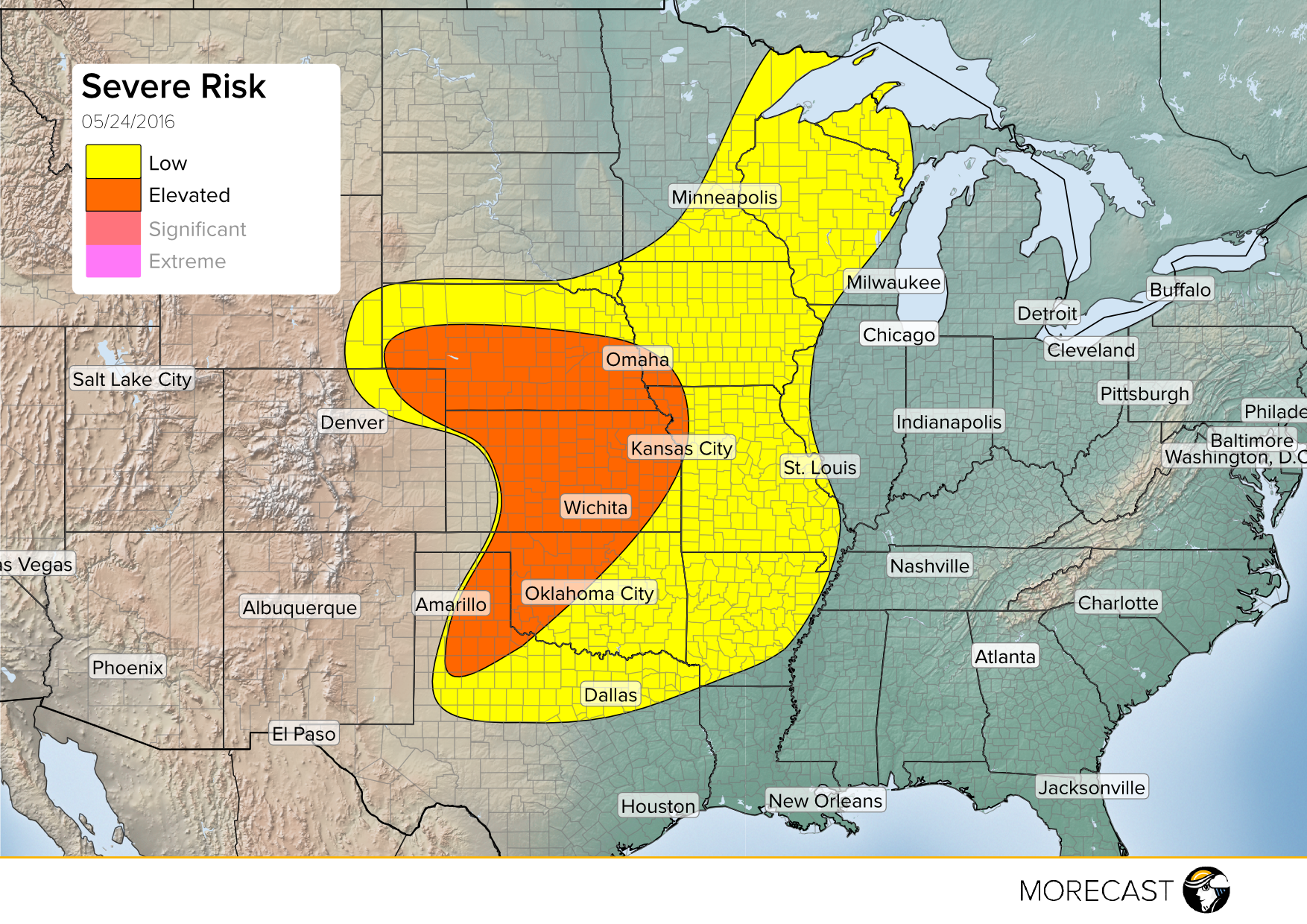
Strong to severe thunderstorms are expected to develop Tuesday afternoon and evening. Low pressure pushing into eastern Colorado and western Kansas as well as a dryline extending from it into Texas will act as triggers for the activity.
The conditions for Tuesday are favorable for supercells across central U.S. Threats of large hail, damaging wind gusts and isolated tornadoes are possible through Oklahoma, Kansas, Nebraska and the panhandle of Texas. In particular the I-35 corridor from Oklahoma City northward through Wichita is at risk for dangerous storms. The greatest chance for tornado spin ups is in west-central Oklahoma due to strong wind shear. The surrounding areas are not expected to see as many storms develop but the storms that do have potential to have strong winds and hail associated with them.
Storms will gradually start to diminish after sunset with the loss of daytime heating but there is a strong low level jet over Kansas and northern Oklahoma Tuesday night which can contribute to keeping storms organized past sunset.
