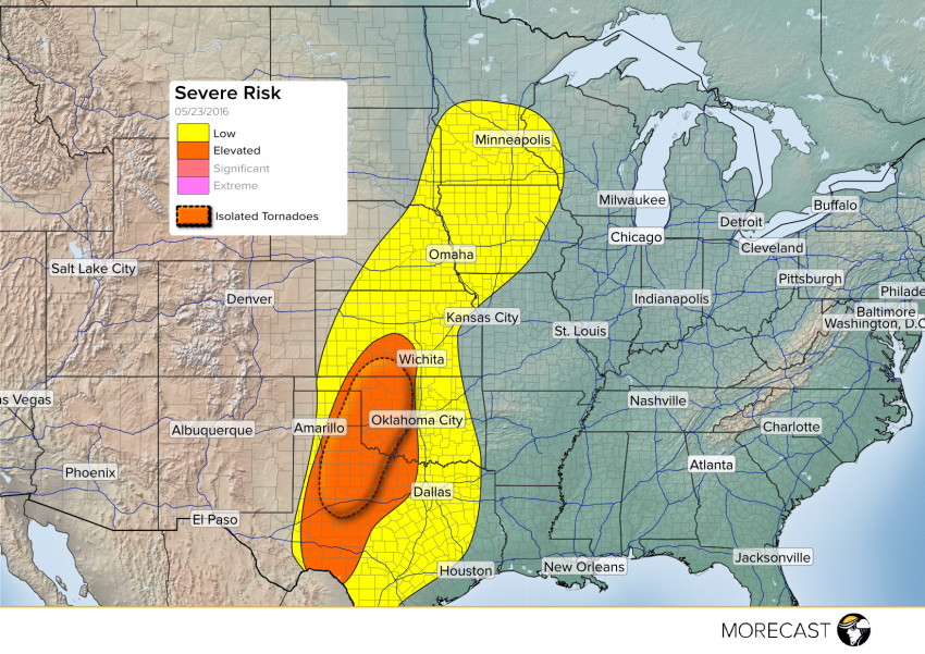
A nearly stationary weather pattern in the upper levels of the atmosphere will support yet another round of severe storms this afternoon across nearly the entire Great Plains and portions of the Upper Midwest.
Another round of severe storms is expected along the dry line Monday afternoon in south-central Kansas, western Oklahoma and the Texas Panhandle, including many of the same areas that have dealt with severe weather the past couple of days. Storms along the dry line will be capable of all severe parameters, including damaging winds, hail up to four inches in diameter, torrential rains and tornadoes.
Also of note will be the presence of strong south-southwesterly winds a couple thousand feet up in the atmosphere. Known as a low level jet, these winds will continue to pump moisture and energy into thunderstorms throughout the central U.S. this evening, meaning the storms will remain organized and strong even after the sun sets.
More storms are likely across portions of Kansas, Nebraska, the Dakotas and Minnesota later today. However, morning convection has diminished the severe threat for later today but storms that do develop will have a threat of isolated hail and strong wind gusts. So make sure to be weather aware if you live in any of the outlined areas throughout the day Monday as well as Monday night.
