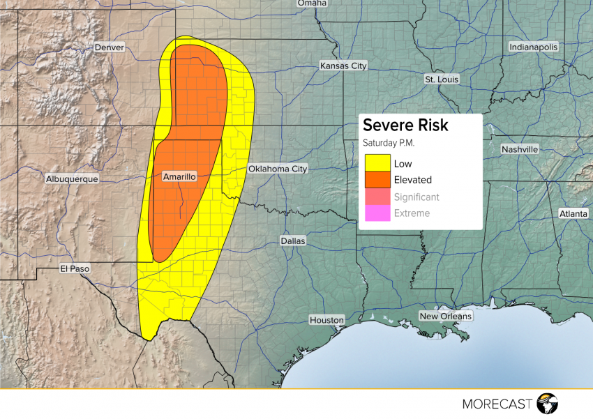
Spotty strong to severe thunderstorms are expected to fire Saturday afternoon and evening along a dry line that extends from western Kansas through the panhandles of Oklahoma and Texas, down into the Big Bend of the Rio Grande River.
Storms that develop in Kansas will have the best chance of producing a few tornadoes, due to the presence of low level shear (turning of the winds) needed by a storm to form a twister. In addition to the tornado threat, large hail and damaging winds will be possible between Dodge City and the Colorado-Kansas border.
More storms will also develop farther south into Texas. In the Panhandle, including Amarillo, storms will be capable of producing hail up to two inches along with damaging winds. While an isolated tornado can’t be ruled out, the tornado threat is lower compared to western Kansas.
A few more storms may fire off from Lubbock to Midland down into the Big Bend of Texas. While these storms will be more isolated in nature, ones that are able to develop will be capable of large hail and strong wind gusts.
Storms will gradually start to diminish after sunset with the loss of daytime heating, with the severe threat ending by midnight.
