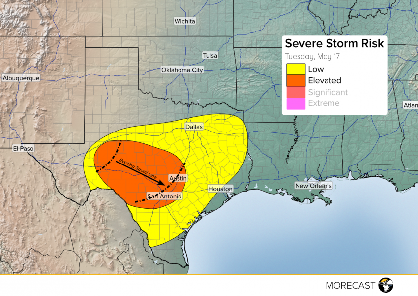
A persistent flow of warm Gulf moisture up into central and western Texas will set the stage for another round of strong to severe storms later Tuesday afternoon through the evening hours. Large hail and damaging winds will be common, and a couple of isolated tornadoes can’t be ruled out! Although upper-level support for organized severe storms will be only marginally favorable, plenty of instability will build up due to afternoon heating. A remnant surface boundary from last night’s storms will be the catalyst for a new round of severe weather developing late this afternoon in west Texas and moving east and southeast. Early individual cells will consolidate into a dangerous squall line by the evening hours, possibly threatening Austin and San Antonio by around midnight or so, although the storms will probably have lost some punch by then. Large hail to 2″ in diameter and an isolated tornado will occur late this afternoon, transitioning to more of a straight-line wind threat by the evening hours with localized gusts to 70 mph.
We’ll send out updates as needed to our Facebook and Twitter pages. You’ll also see the latest information on your MORECAST app!
