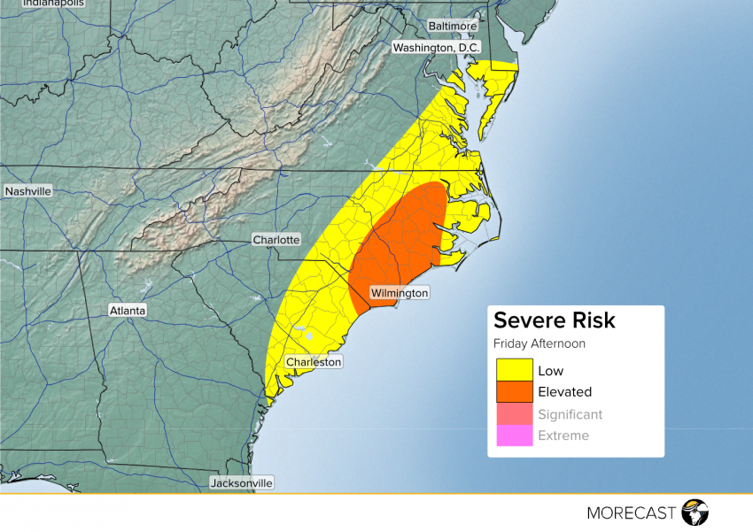
A cold front that extends all the way from the Gulf of Mexico to the Hudson Bay in Canada will allow for some strong to potentially severe storms to ignite in the Carolinas Friday Afternoon. Here’s a look at some of the hazards expected for Friday the 13th.
As the cold front pushes further east this morning and afternoon, it will encounter a somewhat unstable airmass with dewpoints in the mid 60s. This will allow for a few strong storms to form along and east of the cold front. The best location for theses storms will be east of I-95 in the Tar Heel State though the potential for severe weather extends from southern Delaware all the way to Hilton Head, GA. The main threat for these storms will be strong winds as well as small hail. Be sure to upload any pictures of the storms you can safely take to your MORECAST app!
