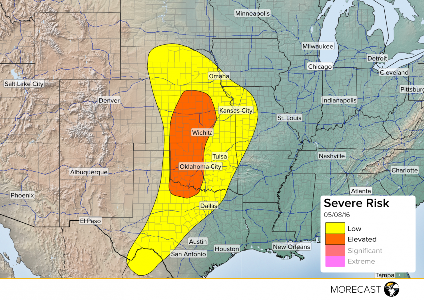
Severe weather ramps back up on Sunday evening. The MORECAST team is forecasting widespread activity across the Central Plains.
With a strong jet streak ramping up over the the Central Plains on Sunday evening, severe weather will get back in gear across the region. Areas from the southern border of Texas to South Dakota will see large hail, damaging winds, and a few tornadoes.
The “hot spot” should be parts of central Oklahoma into Kansas, as the most potent mix of severe weather ingredients come together along a dry line pushing eastward. Good low level shear in our highlighted “Elevated Risk” area will bring with it a risk for strong, and potentially tornadic supercells
With temperatures dropping off sharply with altitude (known as a high lapse rate), large hail will also be a threat. Oklahoma City and areas west will be at most risk, potentially seeing hail up to 3″ in diameter.
Later on, supercell activity should give way to quick moving “line” storms, bringing gusty winds and small hail. Eastern Kansas and Western Missouri should keep an eye out for this into the early morning hours.
Stay up to date with our MORECAST app, available on iOS and Android.
